
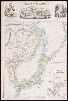
Map of the Island of Japan, Kurile &c. with the Adjacent Coasts of the Chinese Dominions and a Ske...
- People
- Time
- Owner Organization

Map of the Island of Japan, Kurile &c. with the Adjacent Coasts of the Chinese Dominions and a Ske...
Stanford University Libraries
Stanford Libraries SearchWorks
(Lower Sheet to) Map of the Island of Japan, Kurile &c. with the Adjacent Coasts of the Chinese Do...
Stanford University Libraries
Stanford Libraries SearchWorks
Stanford's map of China & Japan with the adjacent parts of the Russian Repubcs. India, Burma &c / Stanford's Geographical Establishment
National Library of Australia
Trove: National Library of Australia

A Map of the East-Indies and the Adjacent Countries; with the Settlements, Factories and Territori...
Stanford University Libraries
Stanford Libraries SearchWorks

A Map of the East-Indies and the Adjacent Countries; with the Settlements, Factories and Territori...
Stanford University Libraries
Stanford Libraries SearchWorks

A Map of the East-Indies and the Adjacent Countries; with the Settlements, Factories and Territori...
Stanford University Libraries
Stanford Libraries SearchWorks

A Map of the East-Indies and the Adjacent Countries; with the Settlements, Factories and Territori...
Stanford University Libraries
Stanford Libraries SearchWorks

Japan, Mandshuria (Showing The Course of the Amur River) The Kurile Isles &c. Accroding to the Bri...
Stanford University Libraries
Stanford Libraries SearchWorks

Japan, Mandshuria (Showing The Course of the Amur River) The Kurile Isles &c. Accroding to the Bri...
Stanford University Libraries
Stanford Libraries SearchWorks
Kurile Islands special strategic map / compiled by the Army Map Service
National Library of Australia
Trove: National Library of Australia
![[Chinese Text with Image of a Map of the World]](https://api.europeana.eu/api/v2/thumbnail-by-url.json?uri=http%3A%2F%2Fmedia.iwm.org.uk%2Fiwm%2FmediaLib%2F191%2Fmedia-191923%2Flarge.jpg&type=IMAGE)
[Chinese Text with Image of a Map of the World]
Imperial War Museum
Europeana API
![Kyūshū no zu [Map of Kyūshū Island, Japan]](https://collections.library.yale.edu/iiif/2/15511841/full/!200,200/0/default.jpg)
Kyūshū no zu [Map of Kyūshū Island, Japan]
Yale University Library
Yale University Library Digital Collections
![Kyūshū no zu [Map of Kyūshū Island, Japan]](https://collections.library.yale.edu/iiif/2/15511837/full/!200,200/0/default.jpg)
Kyūshū no zu [Map of Kyūshū Island, Japan]
Yale University Library
Yale University Library Digital Collections

The railway map of Japan
Boston Public Library
DPLA API

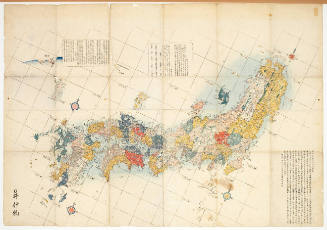
Map of the Empire of Japan
Salem State University Archives and Special Collections
DPLA API

A map of the city of Nagasaki, and of the adjacent country; Sorts of money current in the Japanese Empire
General Research Division. The New York Public Library
DPLA API
Islands of Japan
Yale University Library
Yale University Library Digital Collections
Map of the Japanese Archipelago
Honolulu Museum of Art
Honolulu Museum of Art Collection

Map of Japanese Homeland Island
Philadelphia Museum of Art
Philadelphia Museum of Art collection

A chart of the tradeing part of the East Indies and China, with the adjacent islands, from Surrat ...
Royal Museums Greenwich
Europeana API

Charts, etc
Yale University Library
Yale University Library Digital Collections

Map of the Empire of Japan in 1914
New Zealand Ministry for Culture and Heritage
DigitalNZ New Zealand API

Chinese and Japanese ports. (with) The mainland of Japan with the islands of Kiushiu & Shikoku. Ge...
Stanford University Libraries
Stanford Libraries SearchWorks

A map of the Empire of Japan, made by Dr. Kaempfer [with maps of Kamchatka, Northern coast of Japan, as well...
General Research Division. The New York Public Library
DPLA API
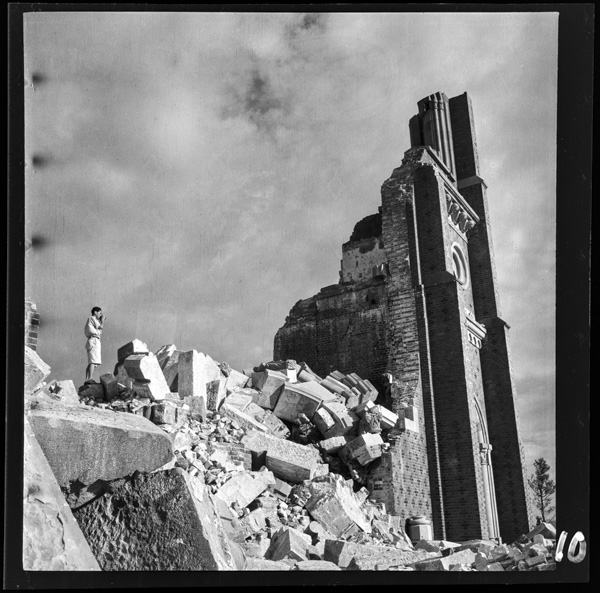
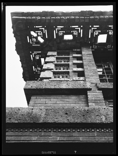
Nagasakiuragamitenshudou kensetsunisanjuunen、hakaihaisshun
Photo Archive Japan
Photo Archive Japan Database

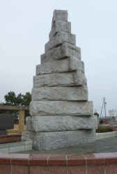
南朝遺蹟 尊雅王位碑
三重県環境生活部文化振興課
Mie Historical & Cultural Walking Map (Regional Cultural Assets)
Kitagawakyakushitsutounosumibuditēru
Photo Archive Japan
Photo Archive Japan Database
Zvonice v zahradě
eSbírky
Europeana API
![Tokio [i.e. Tokyo], Meuo [?] port, daibutsu [statue géante de Bouddha] : [photographie de presse] ...](https://api.europeana.eu/thumbnail/v2/url.json?uri=https%3A%2F%2Fgallica.bnf.fr%2Fiiif%2Fark%3A%2F12148%2Fbtv1b53118756z%2Ff1%2Ffull%2F512%2C%2F0%2Fnative.jpg&type=IMAGE)
Tokio [i.e. Tokyo], Meuo [?] port, daibutsu [statue géante de Bouddha] : [photographie de presse] ...
Bibliothèque nationale de France
Europeana API
モニュメント刻の軌跡
三重県環境生活部文化振興課
Mie Historical & Cultural Walking Map (Regional Cultural Assets)
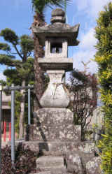
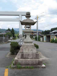
常夜燈
三重県環境生活部文化振興課
Mie Historical & Cultural Walking Map (Regional Cultural Assets)
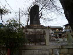
自然石の歌碑
三重県環境生活部文化振興課
Mie Historical & Cultural Walking Map (Regional Cultural Assets)
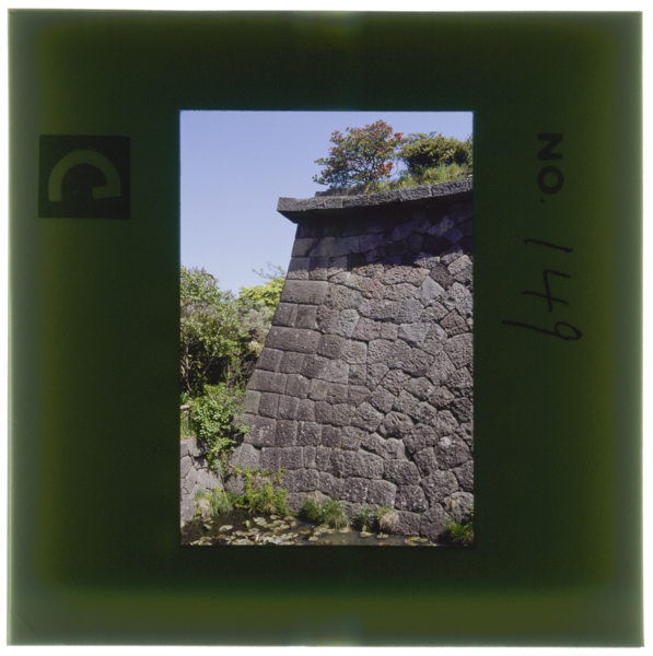
Goryoukakuootegawanoishigakiedokoukinotokuchouwomiserukenchizumidejoutannihanedashigamoukerareteiru
Photo Archive Japan
Photo Archive Japan Database
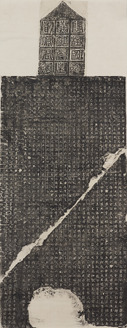
Stele Commemorating the Achievements of the General Huangfu Dan
Tokyo National Museum
Integrated Collections Database of the National Museums, Japan

松山城
NHK Archives
Michi-shiru: Japan Seasonal Journey

flodbank, staty, fotografi, photograph@eng
Museum of Ethnography, Sweden
Europeana API
常夜燈
三重県環境生活部文化振興課
Mie Historical & Cultural Walking Map (Regional Cultural Assets)
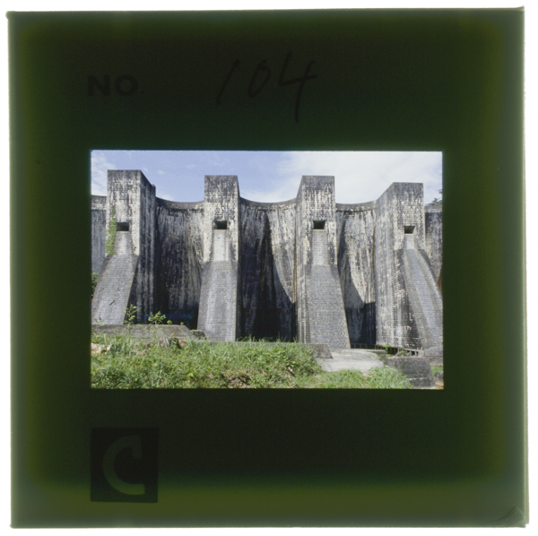
Hounenikeenteitakasa30mētorunagasa145mētoruchuuoubuni5konoāchito6konofuhekiwomotsusekizoumaruchipuruāchidamumezurashiikeishikidedamukensetsuwokokorozasuhitogaichidohabenkyouniotozurerutoiu
Photo Archive Japan
Photo Archive Japan Database
Last Updated: 2020-04-17
Uploaded: 2021-09-21