
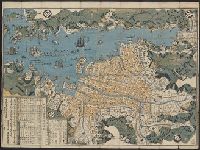
Nagasaki shigai zenzu = The map of nagasaki city. Kiushiu. Japan
- Time
- Owner Organization

Shinchiku shigaizu = : Map of Hsinchu city
Stanford University Libraries
Stanford Libraries SearchWorks

Kagi shigaizu = Map of Chiayi city
Stanford University Libraries
Stanford Libraries SearchWorks

Jitchi tōsoku Kōbe shigai zenzu = New map of Kobe
Stanford University Libraries
Stanford Libraries SearchWorks

Taichū shigaizu = Map of T'ai-chung city
Stanford University Libraries
Stanford Libraries SearchWorks
![Kaisei Atami Shigai Zenzu. [Revised Map of the Entire City of Atami]](https://collections.library.yale.edu/iiif/2/15510883/full/!200,200/0/default.jpg)
Kaisei Atami Shigai Zenzu. [Revised Map of the Entire City of Atami]
Yale University Library
Yale University Library Digital Collections

A map of the city of Nagasaki, and of the adjacent country; Sorts of money current in the Japanese Empire
General Research Division. The New York Public Library
DPLA API
Map of Nagasaki
Yale University Library
Yale University Library Digital Collections

Map of Nagasaki (Hizen Nagasaki zu)
Art Institute of Chicago
Art Institute of Chicago API

Map of Tokyo : city communications
Stanford University Libraries
Stanford Libraries SearchWorks

Map of the Empire of Japan
Salem State University Archives and Special Collections
DPLA API

The railway map of Japan
Boston Public Library
DPLA API
![[Shinkan Nagasaki No Zu. (Newly engraved Map of Nagasaki)]](https://collections.library.yale.edu/iiif/2/15823940/full/!200,200/0/default.jpg)
[Shinkan Nagasaki No Zu. (Newly engraved Map of Nagasaki)]
Yale University Library
Yale University Library Digital Collections

Japan from "The wonderful City of Tokio, etc"
British Library
Europeana API
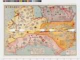
History of Nagasaki City. Source: Translation from map issued to commemorate founding of the city. Report No. 3f(16), USSBS Index Section 2
NDL Digital Collections
NDL Digital Collections

Hawaikoku shotou zenzu = Map of the Hawaiian Islands
NDL Digital Collections
NDL Digital Collections

Kanayacho, Nagasaki, from the series Selection of scenes of Japan
Freer and Sackler
DPLA API

Koubeshi zenzu = Map of Kobe
NDL Digital Collections
NDL Digital Collections

Koubeshi zenzu = Map of Kobe
NDL Digital Collections
NDL Digital Collections

Dai Nihon zenzu (The picture of the Great Whole Map of Japan; Provinces in the Japanese Empire, in...
Stanford University Libraries
Stanford Libraries SearchWorks

Map of the Empire of Japan in 1914
New Zealand Ministry for Culture and Heritage
DigitalNZ New Zealand API

Chinese and Japanese ports. (with) The mainland of Japan with the islands of Kiushiu & Shikoku. Ge...
Stanford University Libraries
Stanford Libraries SearchWorks

SARUSAWA POND, NARA CITY, THE ACIENT CAPITAL OF JAPAN
Auckland Libraries
DigitalNZ New Zealand API

THE "GRAND CANAL" OF TOKYO, THE CAPITAL CITY OF JAPAN
Auckland Libraries
DigitalNZ New Zealand API

(Composite Map of) Map of the Island of Japan, Kurile &c. with the Adjacent Coasts of the Chinese ...
Stanford University Libraries
Stanford Libraries SearchWorks
遍路道中図(四国八十八カ所)
Tokushima Prefectural Archives
ADEAC: A System of Digitalization and Exhibition for Archive Collections
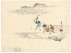
「森狙仙」
Mario Marega Collections, Salesian University, Rome
ARC Ukiyo-e Portal Database

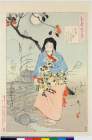
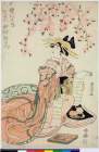
The Spirit of the Komachi Cherry Tree
Philadelphia Museum of Art
Philadelphia Museum of Art collection
Peaches in Buryō (illustration and text) (Buryō Tōgen)
Honolulu Museum of Art
Honolulu Museum of Art Collection

「一文字屋才兵衛 市川団十郎」
Art Research Center, Ritsumeikan University
ARC Ukiyo-e Portal Database

Jūmanbun no ichi Zu Girubāto Shotō
Stanford University Libraries
Stanford Libraries SearchWorks
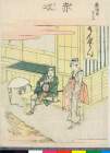
「東海道五十三次」 「赤坂」
British Museum
ARC Ukiyo-e Portal Database
a.jpg)
表紙
大阪府立中之島図書館
ARC Banzuke (Playbills) Portal Database
![Tokyo and vicinity, showing bombed-out areas [cartographic material]](https://stacks.stanford.edu/image/iiif/jx217xm7539%2Fjx217xm7539_00_0001/full/!200,200/0/default.jpg)
Tokyo and vicinity, showing bombed-out areas [cartographic material]
Stanford University Libraries
Stanford Libraries SearchWorks

Japan, Hokushu _ West Coast. Iwanai Byochi and Approaches
Stanford University Libraries
Stanford Libraries SearchWorks
![丹後国[山陰道図]](https://rmda.kulib.kyoto-u.ac.jp/iiif/RB00020042/RB00020042_00001_0.ptif/full/200,/0/default.jpg)
丹後国[山陰道図]
Kyoto University Library
IIIF Discovery in Japan
「つき百姿」 「千代能かいたゝく桶の底ぬけ てミつたまらねハ月もやとらす」
British Museum
ARC Ukiyo-e Portal Database
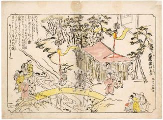
The Awataguchi Festival (Awataguchi Matsuri no Zu), series Views of Kyoto
Honolulu Museum of Art
Honolulu Museum of Art Collection

Tsukinohyakushi
Tokyo Metropolitan Central Library
ARC Ukiyo-e Portal Database

「十二ひと絵」 「師走のむつの花」
Mario Marega Collections, Salesian University, Rome
ARC Ukiyo-e Portal Database

Moon of the Pleasure Quarters, from the series One Hundred Aspects of the Moon
Brooklyn Museum
Brooklyn Museum API
Nijo Castle details (Nijōjō)
Honolulu Museum of Art
Honolulu Museum of Art Collection

Japan Banzai : 100 Selections 100 Smiles(Album) (Russo-Japanese War)
Keio University Media Center
Digital Collections of Keio University Libraries

Tonamigunwakabayashigumiyagimuraryouoyobidoumuraryoutsukigenrokusannenkyouhoujuuichinenbunkajuuninenshinkairyounaikenchiezu
Imizu City Shinminato Museum
ADEAC: A System of Digitalization and Exhibition for Archive Collections
「(松明の男と物を籠で運ぶ二人の男)」
Museum of Fine Arts, Boston
ARC Ukiyo-e Portal Database
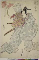
「六弥太 沢村源之助」
Nationaal Museum van Wereldculturen (Rijksmuseum Volkenkunde, Leiden)
ARC Ukiyo-e Portal Database

都市計畫基本圖. : 7 松ヶ崎
Yoshida-South Library, Kyoto University
IIIF Discovery in Japan

高山町及附近略図
Takayamashi Kyoiku Iinkai
ADEAC: A System of Digitalization and Exhibition for Archive Collections
「七変化之内 けいせい 中村歌右衛門」
British Museum
ARC Ukiyo-e Portal Database
Last Updated: 2020-04-17
Uploaded: 2021-09-21