
□□
国文学研究資料館
蔵書印データベース

山梨県管内図
山梨県立図書館
山梨デジタルアーカイブ

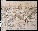
八ヶ嶽南麓図
山梨県立図書館
山梨デジタルアーカイブ

上総九十九里地引網大漁猟正写之図
千葉県立中央図書館
千葉県デジタルアーカイブ

(椎名下郷絵図下書)
千葉県立中央図書館
千葉県デジタルアーカイブ
![[下図]「能州鳳至郡名舟村領舳倉島七ッ島絵図」慶応元年十二月](https://adeac.jp/items/imizu-shinminato-mus/catalog/mp106490-15100/3-1-D120v2.jpg)
[下図]「能州鳳至郡名舟村領舳倉島七ッ島絵図」慶応元年十二月
射水市新湊博物館
ADEAC:デジタルアーカイブシステム
Chūko fukin dai jūni shidan no sentō san-gatsu jūroku-nichi
オーストラリア国立図書館
オーストラリア国立図書館Trove
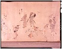
珺玉集
メトロポリタン美術館
ARC古典籍ポータルデータベース
![[下図]「能州口郡分間絵図」文政六年五月](https://adeac.jp/items/imizu-shinminato-mus/catalog/mp106240-15100/3-2-K103v2.jpg)
[下図]「能州口郡分間絵図」文政六年五月
射水市新湊博物館
ADEAC:デジタルアーカイブシステム

唐津字郭内及郭外境界実測図
佐賀県立図書館
IIIF Discovery in Japan
「当世子宝合」
ベルギー王立美術歴史博物館
ARC浮世絵ポータルデータベース

「女芦葉達磨」
ボストン美術館
ARC浮世絵ポータルデータベース
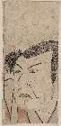
「(役者大首)」
ボストン美術館
ARC浮世絵ポータルデータベース
片田景図(模本)
東京国立博物館
ARC浮世絵ポータルデータベース
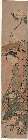
近世職人尽絵詞
東京国立博物館
ARC浮世絵ポータルデータベース
![[下図]「射水郡分間絵図」文政六年九月](https://adeac.jp/items/imizu-shinminato-mus/catalog/mp101660-15100/3-1-BII2v2.jpg)
[下図]「射水郡分間絵図」文政六年九月
射水市新湊博物館
ADEAC:デジタルアーカイブシステム
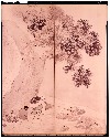
山野行楽図屏風
東京国立博物館
ARC浮世絵ポータルデータベース
「(石橋)」
ボストン美術館
ARC浮世絵ポータルデータベース
登録日: 2026-03-25