

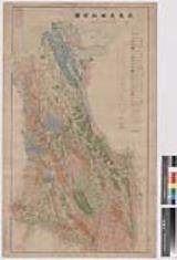
満州地質及鑛産分布圖 : 1
京都大学吉田南総合図書館
IIIF Discovery in Japan

満州地質及鑛産分布圖 : 6
京都大学吉田南総合図書館
IIIF Discovery in Japan

満州地質及鉱産布図 其六
九大コレクション
九大コレクション

満州地質及鉱産布図 其二
九大コレクション
九大コレクション

満州地質及鉱産布図 其四
九大コレクション
九大コレクション

満州地質及鉱産布図 其一
九大コレクション
九大コレクション

満州地質及鉱産布図 其三
九大コレクション
九大コレクション

満州地質及鉱山分布図(其五)
九大コレクション
九大コレクション

満州綿布比較 : 土産綿布
神戸大学附属図書館
神戸大学附属図書館デジタルアーカイブ新聞記事文庫

地質学及採鑛学両学科設置ノ件
東京大学文書館
東京大学学術資産等アーカイブズポータル

満州及接壌地域地形図
九大コレクション
九大コレクション

質屋営業分布
神戸大学附属図書館
神戸大学附属図書館デジタルアーカイブ新聞記事文庫

台中州国姓油田地形及地質図
九大コレクション
九大コレクション

韓国平安道地質及鉱産図
九大コレクション
九大コレクション

韓国咸鏡道地質及鉱産図
九大コレクション
九大コレクション

台北州清水坑油田地形及地質図
九大コレクション
九大コレクション

台北州山子脚油田地形及地質図
九大コレクション
九大コレクション

満洲重要鑛産分布圖
国立国会図書館デジタルコレクション
国立国会図書館デジタルコレクション

満州向綿布(一〜五)
神戸大学附属図書館
神戸大学附属図書館デジタルアーカイブ新聞記事文庫
筑豊炭田地質圖
田川市立図書館
ADEAC:デジタルアーカイブシステム

台湾地質鉱産地図
九大コレクション
九大コレクション

九州炭鉱分布図
九大コレクション
九大コレクション

朝鮮地質鉱産図
九大コレクション
九大コレクション
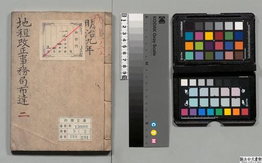
地租改正事務局布達及達2
国立公文書館
国立公文書館デジタルアーカイブ
満州地質及鑛産分布圖 : 1
京都大学吉田南総合図書館
IIIF Discovery in Japan

Central Tokyo : city map.
スタンフォード大学図書館
スタンフォード大学図書館SearchWorks
習志野演習場
船橋市西図書館
ADEAC:デジタルアーカイブシステム
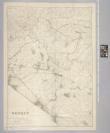
満州地質及鑛産分布圖 : 6
京都大学吉田南総合図書館
IIIF Discovery in Japan
Kyoto South : Kyoto Prefecture, Honshu, Japan
イェール大学図書館
イェール大学図書館デジタルコレクション
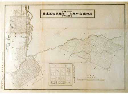
石狩国空知郡チプラソーシ・落合・チプラソンマオール植民地区画図
国土地理院
古地図コレクション

Nara, Yamada, Koyasan, and environs
イェール大学図書館
イェール大学図書館デジタルコレクション

仁比山村城原字切畑全図
佐賀県立図書館
IIIF Discovery in Japan

十万分一圖小興安嶺
スタンフォード大学図書館
スタンフォード大学図書館SearchWorks
最終更新日: 2020-04-16
登録日: 2021-07-27