
Geological Survey of Japan : reconnaissance map, geology : div. 4
- People
- Time
- Owner Organization

Geological Survey of Japan : reconnaissance map, geology : div. 1
Yoshida-South Library, Kyoto University
IIIF Discovery in Japan
GEOLOGICAL SURVEY OF JAPAN
Museum of Oriental Arts, Venice
ARC Early Japanese Book Portal Database
![Imperial Geological Survey of Japan topographical map : Division I-[V]](https://collections.library.yale.edu/iiif/2/15828616/full/!200,200/0/default.jpg)
Imperial Geological Survey of Japan topographical map : Division I-[V]
Yale University Library
Yale University Library Digital Collections
Reconnaissance Soil Survey of Japan Shikoku
NDL Digital Collections
NDL Digital Collections
Reconnaissance Soil Survey of Japan Nagoya Area
NDL Digital Collections
NDL Digital Collections
Reconnaissance Soil Survey of Japan Hiroshima Area
NDL Digital Collections
NDL Digital Collections
Reconnaissance Soil Survey of Japan - Nagoya Area
NDL Digital Collections
NDL Digital Collections
Reconnaissance Soil Survey of Japan Kanto Plain Area
NDL Digital Collections
NDL Digital Collections

Topographical map of the Japanese Empire, 1899 / Imperial Geological Survey of Japan ; drawn by T. Togawa an...
Yale University Library
Yale University Library Digital Collections

GEOLOGICAL MAP COMMONWEALTH OF AUSTRALIA
Kyushu University Collections
Kyushu University Collections

GEOLOGICAL MAP OF THE STATE OF CALIFORNIA
Kyushu University Collections
Kyushu University Collections

The geology of Pennsylvania : a government survey
Department of Science, Kyoto University
IIIF Discovery in Japan

Chishitsu chōsa kenkyū hōkoku = Bulletin of the Geological Survey of Japan
Stanford University Libraries
Stanford Libraries SearchWorks

Headquarters of Geological Society of Japan
マサチューセッツ大学アマースト校図書館特別コレクション
DPLA API
Map of Japan
Univerzita Karlova. Mapová sbírka
Europeana API

Map of Japan
Boston Public Library
DPLA API

Map of Japan
Stanford University Libraries
Stanford Libraries SearchWorks

Map of Japan
Library of Congress
Digital Collections, Library of Congress

Map of Japan
Yoshida-South Library, Kyoto University
IIIF Discovery in Japan

Journal of the Japan Society of Engineering Geology
Jagiellońska Library Cyfrowa
Europeana API

済州島地質図 = Geological Map of Saishuto
Yoshida-South Library, Kyoto University
IIIF Discovery in Japan

New Map of Japan
Stanford University Libraries
Stanford Libraries SearchWorks

Map of the Empire of Japan
Salem State University Archives and Special Collections
DPLA API
Survey of Economic Conditions in Japan
The National Museum of Modern Art, Tokyo
Union Catalog of the Collections of the National Art Museums, Japan
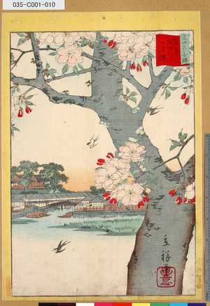
「三十六花撰」「東都隅田川八重桜」 「九」
Tokyo Metropolitan Central Library
ARC Ukiyo-e Portal Database
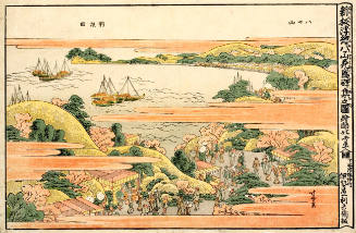
Crowds at the Height of Cherry Blossoms at Yatsuyama, series Newly Published Perspective Pictures
Honolulu Museum of Art
Honolulu Museum of Art Collection
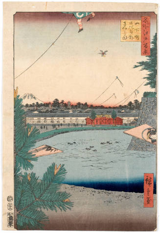
Hibiya and Soto-Sakurada from Yamashita-chō, series One Hundred Famous Views of Edo
Honolulu Museum of Art
Honolulu Museum of Art Collection

Volume 5 from Biography of Prince Shōtoku (Shōtoku Taishi den)
The Chester Beatty Library
Chester Beatty's Digital Collections

大日本帝国播磨但馬淡路全国摂津国西部丹波国西南部兵庫県管内土性図
Yoshida-South Library, Kyoto University
IIIF Discovery in Japan

大日本帝國豫察西南部地質圖
Yoshida-South Library, Kyoto University
IIIF Discovery in Japan
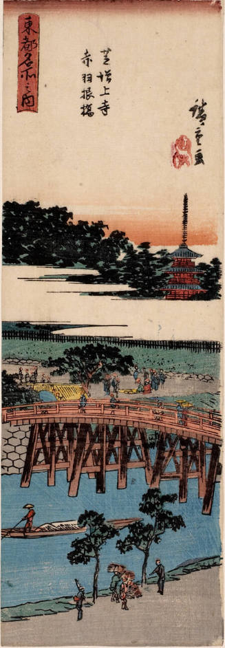
Zōjōji Temple and Akabane Bridge, Shiba, series Famous Views of the Eastern Capital
Honolulu Museum of Art
Honolulu Museum of Art Collection

painting
British Museum
British Museum Collection
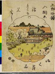
「上野晩鐘」
Nationaal Museum van Wereldculturen (Rijksmuseum Volkenkunde, Leiden)
ARC Ukiyo-e Portal Database

大日本帝國豊後全國豊前國東南部土性圖
Yoshida-South Library, Kyoto University
IIIF Discovery in Japan
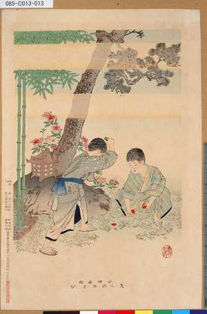
「小供風俗めんこあそび」 「小供風俗」「汐干がりその他」
Tokyo Metropolitan Central Library
ARC Ukiyo-e Portal Database

No 8 Maisaka Imagire (Object); Shirasuka (Object); Mitsuke (Object); Arai (Object); Hamamatsu (Object); Gojusan-tsugi Harimaze (Series)
British Museum
British Museum Collection
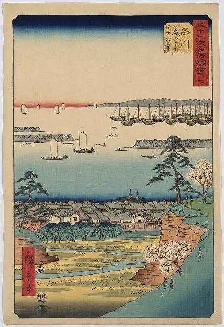
「五十三次名所図会」「二」 「品川 御殿山より駅中を見る」
Library of Congress
ARC Ukiyo-e Portal Database
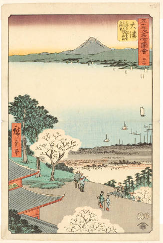
View of Lake Biwa and the Town of Ōtsu from the Building Dedicated to Kannon at Mii Temple
Honolulu Museum of Art
Honolulu Museum of Art Collection
Last Updated: 2020-04-16
Uploaded: 2021-07-27