
Geological Survey of Japan : reconnaissance map, geology : div. 1
- People
- Time
- Owner Organization

Geological Survey of Japan : reconnaissance map, geology : div. 4
Yoshida-South Library, Kyoto University
IIIF Discovery in Japan
GEOLOGICAL SURVEY OF JAPAN
Museum of Oriental Arts, Venice
ARC Early Japanese Book Portal Database
![Imperial Geological Survey of Japan topographical map : Division I-[V]](https://collections.library.yale.edu/iiif/2/15828616/full/!200,200/0/default.jpg)
Imperial Geological Survey of Japan topographical map : Division I-[V]
Yale University Library
Yale University Library Digital Collections
Reconnaissance Soil Survey of Japan Shikoku
NDL Digital Collections
NDL Digital Collections
Reconnaissance Soil Survey of Japan Nagoya Area
NDL Digital Collections
NDL Digital Collections
Reconnaissance Soil Survey of Japan Hiroshima Area
NDL Digital Collections
NDL Digital Collections
Reconnaissance Soil Survey of Japan - Nagoya Area
NDL Digital Collections
NDL Digital Collections
Reconnaissance Soil Survey of Japan Kanto Plain Area
NDL Digital Collections
NDL Digital Collections

Topographical map of the Japanese Empire, 1899 / Imperial Geological Survey of Japan ; drawn by T. Togawa an...
Yale University Library
Yale University Library Digital Collections

GEOLOGICAL MAP COMMONWEALTH OF AUSTRALIA
Kyushu University Collections
Kyushu University Collections

GEOLOGICAL MAP OF THE STATE OF CALIFORNIA
Kyushu University Collections
Kyushu University Collections

The geology of Pennsylvania : a government survey
Department of Science, Kyoto University
IIIF Discovery in Japan

Chishitsu chōsa kenkyū hōkoku = Bulletin of the Geological Survey of Japan
Stanford University Libraries
Stanford Libraries SearchWorks

Headquarters of Geological Society of Japan
マサチューセッツ大学アマースト校図書館特別コレクション
DPLA API
Map of Japan
Univerzita Karlova. Mapová sbírka
Europeana API

Map of Japan
Boston Public Library
DPLA API

Map of Japan
Stanford University Libraries
Stanford Libraries SearchWorks

Map of Japan
Library of Congress
Digital Collections, Library of Congress

Map of Japan
Yoshida-South Library, Kyoto University
IIIF Discovery in Japan

Journal of the Japan Society of Engineering Geology
Jagiellońska Library Cyfrowa
Europeana API

済州島地質図 = Geological Map of Saishuto
Yoshida-South Library, Kyoto University
IIIF Discovery in Japan

New Map of Japan
Stanford University Libraries
Stanford Libraries SearchWorks

Map of the Empire of Japan
Salem State University Archives and Special Collections
DPLA API
Survey of Economic Conditions in Japan
The National Museum of Modern Art, Tokyo
Union Catalog of the Collections of the National Art Museums, Japan

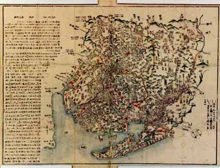
佐賀県管内全図
Saga Prefectual Library
IIIF Discovery in Japan

Take-mika-tsuchi no okami (Object); Katsushika Nijushi-Sho (Series)
British Museum
British Museum Collection
Mikawanokuniyochizenzu
Geospatial Information Authority of Japan
FishPix
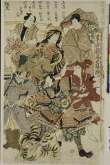
Juunizukishosa、nimaitsuzuki、shougatsu keisei、nigatsu handainari、sangatsu hinaningyou、shigatsu hatsugatsuo、gogatsu toujin、rokugatsu shouseinoningyou(masakiyononingyou)、bandoumitsugorou aitsutomemoushisourou
Nationaal Museum van Wereldculturen (Rijksmuseum Volkenkunde, Leiden)
ARC Ukiyo-e Portal Database
Geological Survey of Japan : reconnaissance map, geology : div. 4
Yoshida-South Library, Kyoto University
IIIF Discovery in Japan

Courtesan with Attendant (Modern Reproduction)
Honolulu Museum of Art
Honolulu Museum of Art Collection
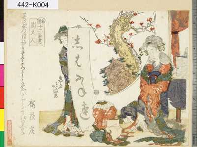
「和漢十二能書」 「衛夫人」
Tokyo Metropolitan Central Library
ARC Ukiyo-e Portal Database

(不動明王)
Nationaal Museum van Wereldculturen (Rijksmuseum Volkenkunde, Leiden)
ARC Ukiyo-e Portal Database

「百人一首之内」 「山辺赤人」
Art Institute of Chicago
ARC Ukiyo-e Portal Database

「三十六佳撰」
Tokyo Metropolitan Central Library
ARC Ukiyo-e Portal Database
Kanadehonchuushingura
Museum of Fine Arts, Boston
ARC Banzuke (Playbills) Portal Database

Woman Playing with a Young Boy
Rijksmuseum
Europeana API

Yamabe no Akahito - No.4 (Object); Hyakunin Isshu no uchi (Series)
British Museum
British Museum Collection

「源氏後集余情」 「紅葉の賀」
Tokyo Metropolitan Central Library
ARC Ukiyo-e Portal Database
Last Updated: 2020-04-16
Uploaded: 2021-07-27