
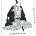
House of Councilors - 7th Diet
NDL Digital Collections
NDL Digital Collections
House of Representatives - 7th Diet
NDL Digital Collections
NDL Digital Collections
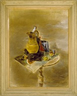
End of Juanita
Brooklyn Museum
Brooklyn Museum API
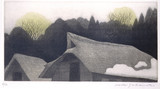
End of Winter
Los Angeles County Museum of Art
Norton Simon Museum Collection

End of the Line
Art Institute of Chicago
Art Institute of Chicago API

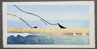
The end of summer
Stanford University Libraries
Stanford Libraries SearchWorks
SCAPIN-695: APPREHENSION OF BURMESE INDIVIDUALS 1946/02/03
NDL Digital Collections
NDL Digital Collections

16th Century Battle Of Nobunaga
Freer and Sackler
DPLA API

Karika, the 7th of the 16 Arhats
Freer and Sackler
DPLA API
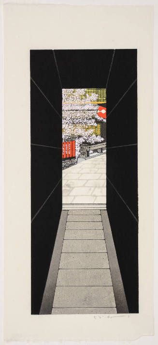
The End of Dark Alley
Honolulu Museum of Art
Honolulu Museum of Art Collection
The End of the Day
Harvard Art Museums
Harvard Art Museums API
Three Scrolls Containing a Reproduction of 14th-Century Pictorial Records of the 6th-Century Gosannen Battle
Metropolitan Museum of Art
The Metropolitan Museum of Art Open Access CSV
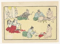
Paper by the 7th Assembly of the WFDY
Contemporary Social History Archives (ASKI)
Europeana API
Court Exh. No. 695: Affidavit of Lt. Gen. Yukio Kasahara of the Japanese Army
NDL Digital Collections
NDL Digital Collections

The End of the Battle of Dogger Bank
Rijksmuseum
Europeana API

End of year market at Asakusa
The Chester Beatty Library
Chester Beatty's Digital Collections
João Rodrigues’s Account of Sixteenth-Century Japan
University of Otago
DigitalNZ New Zealand API
Actor Ichikawa Danjūrō 7th as Conqueror of the Dragon
Harvard Art Museums
Harvard Art Museums API

Portrait of Yugiri - a famous courtesan of the 17th Century
Victoria and Albert Museum
Victoria and Albert Museums API
End of the Summer (Natsu no Owari)
Honolulu Museum of Art
Honolulu Museum of Art Collection

END OF JAPANESE BOMBER ACCLAIMED BY AMERICANS
Auckland Libraries
DigitalNZ New Zealand API

The progress of invention in the nineteenth century
Kansai University Open Research Center for Asian Studies
IIIF Discovery in Japan
Actor Ichikawa Danjūrō 7th in the Role of a Villain
Harvard Art Museums
Harvard Art Museums API
PASSING VIEW OF THE 12 MONTHS THE END OF SPRING
Harvard Art Museums
Harvard Art Museums API

Europe in the reign of Theodoric. C.A.C. 500
Yoshida-South Library, Kyoto University
IIIF Discovery in Japan

Europe in the time of Charles the great 814
Yoshida-South Library, Kyoto University
IIIF Discovery in Japan
![[ローマ帝国道州図]](https://rmda.kulib.kyoto-u.ac.jp/iiif/RB00023933/RB00023933_00001_0.ptif/full/200,/0/default.jpg)
[ローマ帝国道州図]
Yoshida-South Library, Kyoto University
IIIF Discovery in Japan

Greece in the fifth century B.C
Yoshida-South Library, Kyoto University
IIIF Discovery in Japan

Europe showing the general direction of the Barbarian inroads on the fall of the Roman Empire
Yoshida-South Library, Kyoto University
IIIF Discovery in Japan

Asiae Nova Delineatio . .
Stanford University Libraries
Stanford Libraries SearchWorks
Penis opmetingen
Rijksmuseum
Europeana API
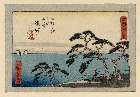
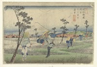
「東海道」 「三十」「五拾三次之内」「五リ半」「濱松」
Museum of Fine Arts, Boston
ARC Ukiyo-e Portal Database
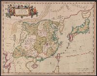
Imperii Sinarum nova descriptio
Yale University Library
Yale University Library Digital Collections
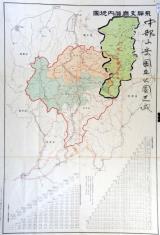
飛騨支庁管内地図(中部山岳国立公園区域図示 角竹記録)附 飛騨支庁管内里程表、各駅間粁数及三等運賃
Takayamashi Kyoiku Iinkai
ADEAC: A System of Digitalization and Exhibition for Archive Collections

Carte des Indes, de la Chine & des Iles de Sumatra, Java &c.
Stanford University Libraries
Stanford Libraries SearchWorks

The world as known to the ancients
Yoshida-South Library, Kyoto University
IIIF Discovery in Japan
![Tokyo and vicinity, showing bombed-out areas [cartographic material]](https://stacks.stanford.edu/image/iiif/jx217xm7539%2Fjx217xm7539_00_0001/full/!200,200/0/default.jpg)
Tokyo and vicinity, showing bombed-out areas [cartographic material]
Stanford University Libraries
Stanford Libraries SearchWorks
Vergezicht op de fonteinvormige berg Fuji gezien vanaf Konosu
Rijksmuseum
Europeana API
Last Updated: 2020-04-16
Uploaded: 2021-07-27