
Europe showing the general direction of the Barbarian inroads on the fall of the Roman Empire
- Owner Organization

The Russian Empire, in Europe and Asia
Stanford University Libraries
Stanford Libraries SearchWorks
Commentaries on the Constitution of the Empire of Japan.
国際日本文化研究センター
Catalogue of the pre-1900 printed books on Japan in European languages held by Nichibunken
Commentaries on the Constitution of the Empire of Japan.
国際日本文化研究センター
Catalogue of the pre-1900 printed books on Japan in European languages held by Nichibunken
General view of commerce & industry in the Empire of Japan.
国際日本文化研究センター
Catalogue of the pre-1900 printed books on Japan in European languages held by Nichibunken

Fall of the Castle
Philadelphia Museum of Art
Philadelphia Museum of Art collection

The fall of Chinchow fort
Freer and Sackler
DPLA API
The birds of the Japanese Empire
American Museum of Natural History Library
Europeana API

The birds of the Japanese Empire
Cornell University Library
Europeana API

The birds of the Japanese Empire
American Museum of Natural History Library
Europeana API
The birds of the Japanese Empire.
国際日本文化研究センター
Catalogue of the pre-1900 printed books on Japan in European languages held by Nichibunken

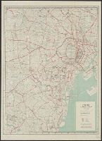
Map of the Empire of Japan
Salem State University Archives and Special Collections
DPLA API
Memorials of the empire of Japon.
国際日本文化研究センター
Catalogue of the pre-1900 printed books on Japan in European languages held by Nichibunken
History of the Empire of Japan.
国際日本文化研究センター
Catalogue of the pre-1900 printed books on Japan in European languages held by Nichibunken

Italy before the growth of the Roman Power
Yoshida-South Library, Kyoto University
IIIF Discovery in Japan

The Oxford handbook of the ends of empire
Stanford University Libraries
Stanford Libraries SearchWorks
Picture of the Fall of Lüshun Port
Minneapolis Institute of Arts
Minneapolis Institute of Art API
View of the Fall of Chinchow Fort
Minneapolis Institute of Arts
Minneapolis Institute of Art API
City map, central Tokyo. December 1946 / prepared under direction of the chief engineer, general headquarter...
Yale University Library
Yale University Library Digital Collections

View of Kyoto from the direction of Sanjo Bridge
The Miriam and Ira D. Wallach Division of Art, Prints and Photographs. The New York Public Library
DPLA API

Illustrations of Sericulture in the Empire
Freer and Sackler
DPLA API

Illustrations of Sericulture in the Empire
Freer and Sackler
DPLA API
A bibliography of the Japanese Empire.
国際日本文化研究センター
Catalogue of the pre-1900 printed books on Japan in European languages held by Nichibunken

Map of the Empire of Japan in 1914
New Zealand Ministry for Culture and Heritage
DigitalNZ New Zealand API

Europe in the time of Charles the great 814
Yoshida-South Library, Kyoto University
IIIF Discovery in Japan
Europe in the time of Charles the great 814
Yoshida-South Library, Kyoto University
IIIF Discovery in Japan

Europa : end of 7th century. 695
Yoshida-South Library, Kyoto University
IIIF Discovery in Japan

Carte de l'isle de Ieso et de ses environs pour servir à concilier les différentes idées que l'on ...
Bibliothèque nationale de France
Europeana API
![Tokyo and vicinity, showing bombed-out areas [cartographic material]](https://stacks.stanford.edu/image/iiif/jx217xm7539%2Fjx217xm7539_00_0001/full/!200,200/0/default.jpg)
Tokyo and vicinity, showing bombed-out areas [cartographic material]
Stanford University Libraries
Stanford Libraries SearchWorks

Greece in the fifth century B.C
Yoshida-South Library, Kyoto University
IIIF Discovery in Japan

Europe in the reign of Theodoric. C.A.C. 500
Yoshida-South Library, Kyoto University
IIIF Discovery in Japan

A New and Correct Chart of all the Known World Laid down according to Mercator's Projection
Stanford University Libraries
Stanford Libraries SearchWorks

General map of China and adjacent regions, showing treaty ports and railways
Stanford University Libraries
Stanford Libraries SearchWorks

Asia recens summa cura delineata Auct. Henr. Hondio 1631
Stanford University Libraries
Stanford Libraries SearchWorks

The world as known to the ancients
Yoshida-South Library, Kyoto University
IIIF Discovery in Japan

Asiae Nova Delineatio . .
Stanford University Libraries
Stanford Libraries SearchWorks
Last Updated: 2020-04-16
Uploaded: 2021-07-27