

中支方面概見圖
Yoshida-South Library, Kyoto University
IIIF Discovery in Japan

北支那事変
Kochi Prefectural Library
OTEPIA Kochi Library collection search

支那事変勃発以降支那方面陸海軍主要作戦概見表
神戸大学附属図書館
Kobe University Library Digital Archive Newspaper Clippings Collection
北支方面作戦記録
NDL Digital Collections
NDL Digital Collections

「北支事変」 戦友第326附録
Kochi Prefectural Library
OTEPIA Kochi Library collection search
支那事変国債
Edo-Tokyo Museum
Tokyo Museum Collection

支那事変国債
Edo-Tokyo Museum
Tokyo Museum Collection

支那事変国債
Edo-Tokyo Museum
Tokyo Museum Collection

支那事変国債
Edo-Tokyo Museum
Tokyo Museum Collection

支那事変国債
Fukuoka City Museum
Fukuoka City Museum Collection Database

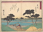
図面(北村)
Kochi Prefectural Library
OTEPIA Kochi Library collection search

アルバム(支那事変記念)
Fukuoka City Museum
Fukuoka City Museum Collection Database

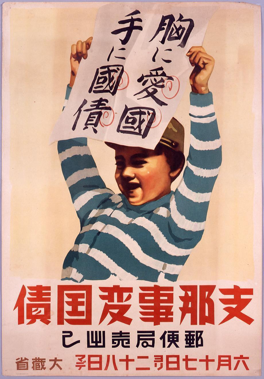
ポスター「支那事変国債」
Fukuoka City Museum
Fukuoka City Museum Collection Database

ポスター「支那事変国債」
Fukuoka City Museum
Fukuoka City Museum Collection Database

ポスター「支那事変国債」
Fukuoka City Museum
Fukuoka City Museum Collection Database

ポスター「支那事変国債」
Fukuoka City Museum
Fukuoka City Museum Collection Database

支那事変と列強
神戸大学附属図書館
Kobe University Library Digital Archive Newspaper Clippings Collection

変更せる対支方針
神戸大学附属図書館
Kobe University Library Digital Archive Newspaper Clippings Collection

北支事変特報 出動命令を受けて
Kochi Prefectural Library
OTEPIA Kochi Library collection search

支那事変従軍記章
Fukuoka City Museum
Fukuoka City Museum Collection Database

「繪葉書帖」 支那事変
Kochi Prefectural Library
OTEPIA Kochi Library collection search
「支那事変 銃後の護」
RHAM
ARC Ukiyo-e Portal Database

南側から見た大分駅北口方面
city of oita official digital archive
city of oita official digital archive

各方面で事変を観る : 誰が出ても支那統一は至難
神戸大学附属図書館
Kobe University Library Digital Archive Newspaper Clippings Collection
中支方面概見圖
Yoshida-South Library, Kyoto University
IIIF Discovery in Japan

A New and Correct Chart of all the Known World Laid down according to Mercator's Projection
Stanford University Libraries
Stanford Libraries SearchWorks

Asiae Nova Descriptio
Stanford University Libraries
Stanford Libraries SearchWorks

Karte von Australien oder Polynesien, nach den Zeichnungen, Reisebe Schreibungen und Tagebucher de...
Stanford University Libraries
Stanford Libraries SearchWorks

A New and Correct Chart of all the Known World Laid down according to Mercator's Projection
Stanford University Libraries
Stanford Libraries SearchWorks
Träsnitt, Bildkonst, Woodblock, Woodcut, Print
Museum of Far Eastern Antiquities, Stockholm
Europeana API
![Tokyo city proper [cartographic material]](https://stacks.stanford.edu/image/iiif/vj067cj0650%2Fvj067cj0650_00_0001/full/!200,200/0/default.jpg)
Tokyo city proper [cartographic material]
Stanford University Libraries
Stanford Libraries SearchWorks
Mitsuki
Metropolitan Museum of Art
The Metropolitan Museum of Art Open Access CSV
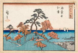
Autumn Leaves at Kaianji Temple (Kaian-ji Kōyō), series Twelve Views of Edo
Honolulu Museum of Art
Honolulu Museum of Art Collection

Northwestern America Showing The Territory Ceded By Russia To The United States Compiled For The D...
Stanford University Libraries
Stanford Libraries SearchWorks

Il Regno Della China detto presentamente Catay e Mangin . . . 1682
Stanford University Libraries
Stanford Libraries SearchWorks

<i>Hawk</i>
Kyushu National Museum
Integrated Collections Database of the National Museums, Japan
Last Updated: 2020-04-16
Uploaded: 2021-07-27