

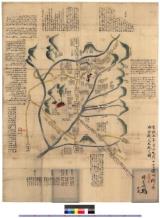
関ケ原合戦絵巻
National Diet Library, Japan
ARC Early Japanese Book Portal Database

関ケ原合戦絵巻
National Diet Library, Japan
ARC Early Japanese Book Portal Database

関ケ原合戦絵巻
National Diet Library, Japan
ARC Early Japanese Book Portal Database

関ケ原合戦絵巻
National Diet Library, Japan
ARC Early Japanese Book Portal Database

関ケ原合戦絵巻
National Diet Library, Japan
ARC Early Japanese Book Portal Database

関ケ原合戦絵巻
National Diet Library, Japan
ARC Early Japanese Book Portal Database
![[歴民カード_歴史] 関ケ原合戦図](https://khirin-i.rekihaku.ac.jp/iiif/nmjh_rekimin_h/10947014_02.tif/full/200,/0/default.jpg)
[歴民カード_歴史] 関ケ原合戦図
National Museum of Japanese History
IIIF Discovery in Japan

関ヶ原合戦図
Fukuoka City Museum
Fukuoka City Museum Collection Database

関ヶ原合戦図
Fukuoka City Museum
Fukuoka City Museum Collection Database
(関ヶ原合戦図)
Sekigahara Town History and Folklore Museum
Sekigahara Collection Database

関ケ原合戦屏風絵(模本)
Tokyo National Museum
Integrated Collections Database of the National Museums, Japan
「粟津ケ原大合戦之図」
Museum of Fine Arts, Boston
ARC Ukiyo-e Portal Database
「粟津ケ原大合戦之図」
Museum of Fine Arts, Boston
ARC Ukiyo-e Portal Database
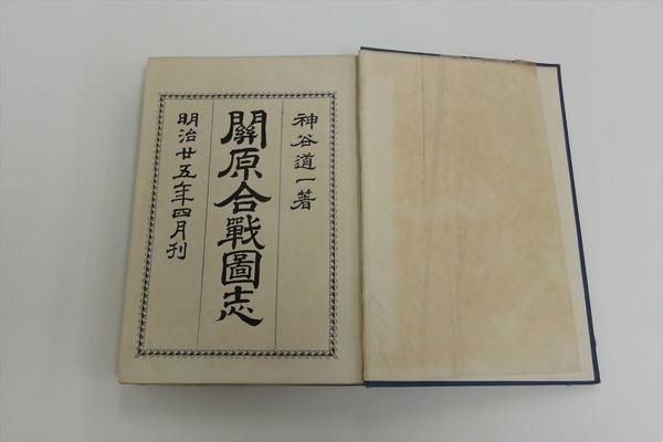
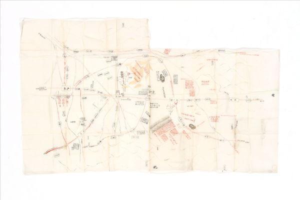
関ヶ原合戦図志
Sekigahara Town History and Folklore Museum
Sekigahara Collection Database

合戦図集成 関か原合戦之図 : 合戦図集成
Iwase Bunko Libray
ADEAC: A System of Digitalization and Exhibition for Archive Collections

合戦図集成 関ヶ原合戦之図 : 合戦図集成
Iwase Bunko Libray
ADEAC: A System of Digitalization and Exhibition for Archive Collections
関ヶ原合戦人数配図 : 関ヶ原合戦人数配図
Iwase Bunko Libray
ADEAC: A System of Digitalization and Exhibition for Archive Collections
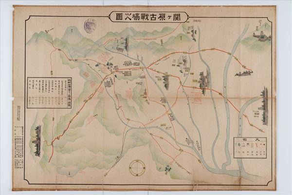
関ヶ原古戦場之図
Sekigahara Town History and Folklore Museum
Sekigahara Collection Database
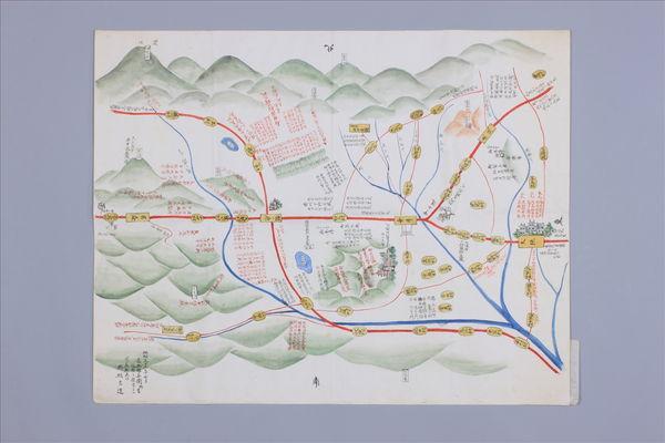
(関ヶ原合戦陣形図)
Sekigahara Town History and Folklore Museum
Sekigahara Collection Database
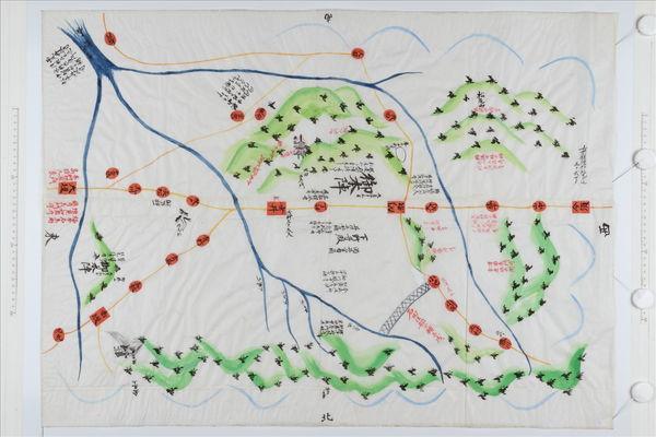
関ヶ原合戦御陣図
Sekigahara Town History and Folklore Museum
Sekigahara Collection Database
.jpg)
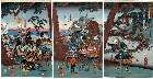
「関ヶ原大合戦之図」 「関ヶ原大合戦之図(三枚続)」
Tokyo Metropolitan Central Library
ARC Ukiyo-e Portal Database
.jpg)
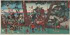
「関ヶ原大合戦之図」 「関ヶ原大合戦之図(三枚続)」
Tokyo Metropolitan Central Library
ARC Ukiyo-e Portal Database
.jpg)
「関ヶ原大合戦之図」 「関ヶ原大合戦之図(三枚続)」
Tokyo Metropolitan Central Library
ARC Ukiyo-e Portal Database
.jpg)
「関ヶ原大合戦之図」 「関ヶ原大合戦之図(三枚続)」
Tokyo Metropolitan Central Library
ARC Ukiyo-e Portal Database

Metropolitan Museum of Art
The Metropolitan Museum of Art Open Access CSV

三国通覧輿地路程全圖 /
Library of Congress
Digital Collections, Library of Congress

A Map of the East-Indies and the Adjacent Countries; with the Settlements, Factories and Territori...
Stanford University Libraries
Stanford Libraries SearchWorks

祭山/羅漢図
Tokyo National Museum
Integrated Collections Database of the National Museums, Japan
![[歴民カード_歴史] 南蛮屏風](https://khirin-i.rekihaku.ac.jp/iiif/nmjh_rekimin_h/12348055_02.tif/full/200,/0/default.jpg)
[歴民カード_歴史] 南蛮屏風
National Museum of Japanese History
IIIF Discovery in Japan
「東海道五拾三駅五宿名所」 「十二枚のうち」「大磯」「小田原」「箱根」「三島」「沼津」
Metropolitan Museum of Art
ARC Ukiyo-e Portal Database
Metropolitan Museum of Art
The Metropolitan Museum of Art Open Access CSV

Nippori, from the illustrated book "Picture Book of Amusements of the East (Ehon Azuma asobi)"
Art Institute of Chicago
Art Institute of Chicago API
![[Untitled Map of the Ancient World : Europe, Asia and Africa]](https://stacks.stanford.edu/image/iiif/ss295kf6573%2F37437/full/!200,200/0/default.jpg)
[Untitled Map of the Ancient World : Europe, Asia and Africa]
Stanford University Libraries
Stanford Libraries SearchWorks
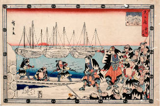
Act 12 (Jūnidan-me), series The Treasury of Loyal Retainers
Honolulu Museum of Art
Honolulu Museum of Art Collection

「青楼名君自筆集」
British Museum
ARC Ukiyo-e Portal Database
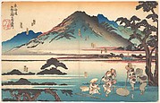
「近江八景」 「瀬田夕照」
Ukiyoe taika shuusei
ARC Ukiyo-e Portal Database

「東海道」「五十三次」 「二川」
Art Institute of Chicago
ARC Ukiyo-e Portal Database
Last Updated: 2020-04-16
Uploaded: 2021-07-27