Map of Foreign Ships (Perry Expedition) in Edo Bay
- Time
- Owner Organization

Untitled (The U. S. Squadron at the Bay of Edo During the First Expedition of Commodore Matthew C. Perry to ...

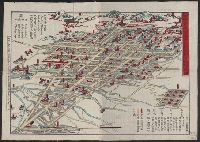
Map of Edo (Ōedo dai ezu)

Map of Edo and Its Environs
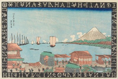
Map of American ships arriving at Uraga
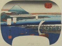
Ships entering the bay of Mt. Tempō

Tsukuda Bay in Edo (Tōto tsukuda oki)
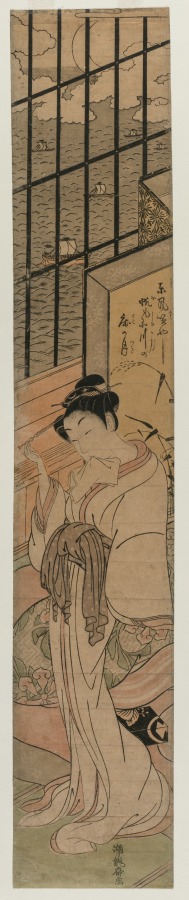
Courtesan in a Room Overlooking Edo Bay

map from "Notes on the late expedition against the Russian settlements in Eastern Siberia; and of ...

Facsimile of the official map made by Abel Janszoon Tasman's expedition to Japan in 1639
Reconnoissance of the Gulf and survey of the western shore of the Bay of Yedo / by order of Commodore M.C. Perry U.S.N. by Lieut. W.L. Maury and other officers of the U.S. Japan Expedition in 1853-54 ; drawn by Edw. Sels ; engr. by Selmar Siebert
![[Plan of Tianjin, China with Foreign Concessions] Tianjin di tu / Map of Tientsin](https://stacks.stanford.edu/image/iiif/vt775gn2391%2F36094/full/!200,200/0/default.jpg)
[Plan of Tianjin, China with Foreign Concessions] Tianjin di tu / Map of Tientsin

Map of the Empire of Japan in 1914
Western shore of the Bay of Yedo / surveyed by order of Commodore M.C. Perry U.S.N. by Lieut. Wm. L. Maury and other officers of the Japan Expedition 1854 ; drawn by Edward Sels ; engraved by Selmar Siebert
![[Map of Marinduque, Philippines, in Japanese.]](https://collections.library.yale.edu/iiif/2/15251559/full/!200,200/0/default.jpg)
[Map of Marinduque, Philippines, in Japanese.]
[Birds-eye view of first landing at Kurihama Beach near Uraga, Tokyo Bay, July 14 1853, by US Navy Commodore Matthew Perry, Special American Diplomatic Expedition]

A New and Accurate Map of the Colony of Massachusets Bay, In North America from a Late Survey

A New and Accurate Map of the Colony of Massachusets Bay, In North America from a Late Survey
"View of Takanawa in Edo"

Illustrations of Famous Places in Edo, 17 (Edo meisho zu-e)
![[Map of part of Samar, Philippines, in Japanese.]](https://collections.library.yale.edu/iiif/2/15251561/full/!200,200/0/default.jpg)
[Map of part of Samar, Philippines, in Japanese.]
View of Miho Bay in Suruga Province
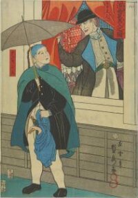
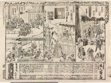
Picture of foreign merchants in Yokohama
The American expedition, under Commodore Perry, landing in Japan, July 14, 1853 / Lith. & print by Hatch & Severyn, 140 Fulton St. N.Y. ; Severyn del

Fishing Boats near Eitai Bridge in Tsukuda Bay (Eitaibashi Tsukuda oki isaribune), from the series "Famous Places in Edo (Edo meisho no uchi)"
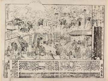
Picture of the Current Confrontation of Americans in Japan (Kono tabi amerikajin dai nihon taimen no zu)
![Nerikuyouimosenoennichi、michiyukiomoinotamakazura、[zensei]toragaishi](http://mfas3.s3.amazonaws.com/styles/grid-2_thumbnail_retina/s3/objects/SC210409.jpg)
Nerikuyouimosenoennichi、michiyukiomoinotamakazura、[zensei]toragaishi
「新板 忠臣蔵十一段続飛回双六」

Ningyoubanzukeshuu
Shinzoutsurifunekidan、kasanetsumaneyanosayoginu、genpeitsutsuji、edonohanahiyoshinonerimono、satomihakkenden

Koharunoenmitsugumisakazuki
![[歴民カード_歴史] 南部絵暦(盛岡盲暦)](https://khirin-i.rekihaku.ac.jp/iiif/nmjh_rekimin_h/10348097_02.tif/full/200,/0/default.jpg)
[歴民カード_歴史] 南部絵暦(盛岡盲暦)

Hayariutahiyokunomitsumon、chigirigusanagarenoadayume

「尾陽熱田駅亀足山正覚寺境内図」
![Aikikyoukariganegomon、edomurasakimusumedoujouji、[keiseishigurenosakura]](http://mfas3.s3.amazonaws.com/styles/grid-2_thumbnail_retina/s3/objects/SC210037.jpg)
Aikikyoukariganegomon、edomurasakimusumedoujouji、[keiseishigurenosakura]
「鼠ノよめ入」 「鼠のよめ入り」
Ryoutomimasutakanenokumokiri、miwoshiruameyokoniaigasa、sodebyoubuironotetsuke
![[歴民カード_歴史] 富士の巻狩陣取○図](https://khirin-i.rekihaku.ac.jp/iiif/nmjh_rekimin_h/12747087_02.tif/full/200,/0/default.jpg)
[歴民カード_歴史] 富士の巻狩陣取○図
![[歴民カード_歴史] 南部絵暦(盛岡盲暦)](https://khirin-i.rekihaku.ac.jp/iiif/nmjh_rekimin_h/10348063_02.tif/full/200,/0/default.jpg)
[歴民カード_歴史] 南部絵暦(盛岡盲暦)
Igagoedouchuusugoroku
![[歴民カード_歴史] 猫間川堀浚図](https://khirin-i.rekihaku.ac.jp/iiif/nmjh_rekimin_h/12747071_02.tif/full/200,/0/default.jpg)
[歴民カード_歴史] 猫間川堀浚図
Koimoyoufurisodemyouto、narukami、hanakyoudaisatsukinoyobanashi
「豊前国下毛郡羅漢寺之図」 「呼名羅漢寺」「申二百七十九番」
![[双六集]新板天神盡飛廻雙六](https://lapis.nichibun.ac.jp/image?did=6&pic=2&fid=11-4-3_01_01.jpg)
[双六集]新板天神盡飛廻雙六
下總國小金ヶ原日暮御鹿狩圖
Map of Niigate

Maris Pacifici Vulgo Mar del zur
![[歴民カード_歴史] 売薬版画 芝居絵](https://khirin-i.rekihaku.ac.jp/iiif/nmjh_rekimin_h/11647039_02.tif/full/200,/0/default.jpg)
[歴民カード_歴史] 売薬版画 芝居絵

Eastern Archipelago : Eastern Part of Celebes
Last Updated:
Uploaded: 2021-07-21