
A chart of the Tartarian Sea from Nova Zemla to Japan
- Time
- Owner Organization

't Ooster deel van Oost Indien, streckende van Ceylon tot Japan en Hollandia Nova
Royal Museums Greenwich
Europeana API
<i>The New and Accurate Map of Japan, Ezo, and Adjacent Islands</i>
Kyushu National Museum
Integrated Collections Database of the National Museums, Japan
![Noordoost Cust Van Asia Van Japan tot Nova Zemla [Gold Highlighted!]](https://stacks.stanford.edu/image/iiif/zc604np2680%2F17235/full/!200,200/0/default.jpg)
Noordoost Cust Van Asia Van Japan tot Nova Zemla [Gold Highlighted!]
Stanford University Libraries
Stanford Libraries SearchWorks

Carte particulière des isles du Japon et partie des costes de la Chine
Bibliothèque nationale de France
Europeana API

Chart of the Coast of China from Cambodia to Nanquam with Part of Japan
Stanford University Libraries
Stanford Libraries SearchWorks
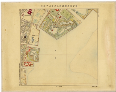
東京府武蔵国芝区芝濱崎町近傍
Geospatial Information Authority of Japan
FishPix
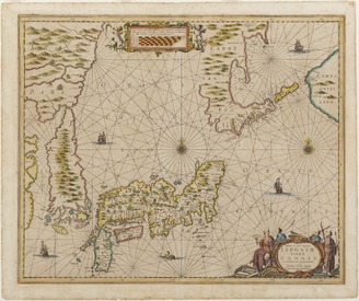
Nova et accvrata Iaponiæ, Terræ Esonis ac insularum adjacentium ex novißima detectione descriptio
VU University Amsterdam Library
Europeana API

drawing
British Museum
British Museum Collection
A Chart of the Northern Part of the China Sea [Material cartográfico] : shewing the Passage from F...
Biblioteca Nacional de España
Europeana API
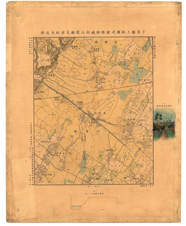
千葉縣上總國武射郡姫嶋村山邊郡菱沼村及近傍
Geospatial Information Authority of Japan
FishPix

Manengannenchizu
Photo Archive Japan Database

A chart of the easternmost part of the East Indies with all the adjacent islands from Cape Comorin...
Royal Museums Greenwich
Europeana API
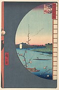
「名所江戸百景」 「真崎辺より水神の森内川関屋の里を見る図」
Metropolitan Museum of Art
ARC Ukiyo-e Portal Database
The Suijin Temple Grove, Uchikawa, and the Village of Sekiya
Metropolitan Museum of Art
The Metropolitan Museum of Art Open Access CSV

Seekarte vom Pazifischen Ozean mit Kalifornien als Insel , ca. 1:21 500 000, Kupferstich, 1715
Deutsche Fotothek
Europeana API

鳴子に雀図
Aichi Prefectural Museum of Art
The collection of Aichi Prefectural Museum of Art

Part 5, Volume 7 of Picture book of the exploits of Toyotomi Hideyoshi (Ehon Toyotomi kunkōki gohen shichi)
The Chester Beatty Library
Chester Beatty's Digital Collections

British Museum
British Museum Collection
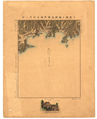
千葉縣上總國夷隅郡興津村外三村
Geospatial Information Authority of Japan
FishPix
Last Updated:
Uploaded: 2021-07-27