
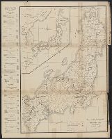
![[Highway map of the Tokyo region].](https://stacks.stanford.edu/image/iiif/gm158cc8245%2Fgm158cc8245_0001/full/!200,200/0/default.jpg)
[Highway map of the Tokyo region].
Stanford University Libraries
Stanford Libraries SearchWorks

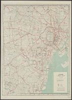
Map of Tokyo and Yokohama
Freer and Sackler
DPLA API
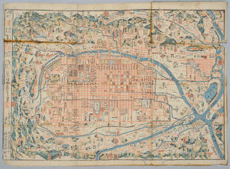
![Eifuku Tokyo go-ezu [Illustrated map of Tokyo]](https://collections.library.yale.edu/iiif/2/15511725/full/!200,200/0/default.jpg)
Eifuku Tokyo go-ezu [Illustrated map of Tokyo]
Yale University Library
Yale University Library Digital Collections
Map of the missionary districts of north Tokyo & Kyoto : under the jurisdiction of the Bishop of Tokyo 1895
Yale University Library
Yale University Library Digital Collections

Central Tokyo : city map.
Stanford University Libraries
Stanford Libraries SearchWorks

Tokyo city plan
Stanford University Libraries
Stanford Libraries SearchWorks
![Tokyo : [base map showing political divisions]](https://stacks.stanford.edu/image/iiif/jw443fg4075%2Fjw443fg4075_00_0001/full/!200,200/0/default.jpg)
Tokyo : [base map showing political divisions]
Stanford University Libraries
Stanford Libraries SearchWorks

Guide to Tokyo City
Yale University Library
Yale University Library Digital Collections

Town plan of Wakayama
Monash University Library
Trove: National Library of Australia
![[Map of Kyoto]](https://collections.library.yale.edu/iiif/2/15510884/full/!200,200/0/default.jpg)
[Map of Kyoto]
Yale University Library
Yale University Library Digital Collections
Map of Kyoto
Honolulu Museum of Art
Honolulu Museum of Art Collection
[Map of Kyoto]
National Library of Australia
Trove: National Library of Australia

Map of Kyoto
Philadelphia Museum of Art
Philadelphia Museum of Art collection
Tokyo city plan : Marunouchi
National Library of Australia
Trove: National Library of Australia

CAPITAL OF DEFEATED JAPAN: TOKYO AREA CHOSEN FOR FIRST ALLIED LANDINGS
Auckland Libraries
DigitalNZ New Zealand API
City map, central Tokyo. December 1946 / prepared under direction of the chief engineer, general headquarter...
Yale University Library
Yale University Library Digital Collections
![[The Bridge of Tokyo City.]](https://api.europeana.eu/api/v2/thumbnail-by-url.json?uri=http%3A%2F%2Fwww.beeldbankwo2.nl%2Fcgi-bin%2Ffrsiserver.dll%2Fthumbnail%2F49348-thumb.jpg%3Ffrskey%3D49348&type=IMAGE)
[The Bridge of Tokyo City.]
NIOD Institute for War, Holocaust and Genocide Studies
Europeana API

Bilingual map of Greater Tokyo. Prepared by the Cartographic Division of King Associates. Publishe...
Stanford University Libraries
Stanford Libraries SearchWorks
![[Profile of Tokyo.]](https://api.europeana.eu/api/v2/thumbnail-by-url.json?uri=http%3A%2F%2Fwww.beeldbankwo2.nl%2Fcgi-bin%2Ffrsiserver.dll%2Fthumbnail%2F49356-thumb.jpg%3Ffrskey%3D49356&type=IMAGE)
[Profile of Tokyo.]
NIOD Institute for War, Holocaust and Genocide Studies
Europeana API
![[Profile of Tokyo.]](https://api.europeana.eu/api/v2/thumbnail-by-url.json?uri=http%3A%2F%2Fwww.beeldbankwo2.nl%2Fcgi-bin%2Ffrsiserver.dll%2Fthumbnail%2F49352-thumb.jpg%3Ffrskey%3D49352&type=IMAGE)
[Profile of Tokyo.]
NIOD Institute for War, Holocaust and Genocide Studies
Europeana API
![[Profile of Tokyo.]](https://api.europeana.eu/api/v2/thumbnail-by-url.json?uri=http%3A%2F%2Fwww.beeldbankwo2.nl%2Fcgi-bin%2Ffrsiserver.dll%2Fthumbnail%2F49357-thumb.jpg%3Ffrskey%3D49357&type=IMAGE)
[Profile of Tokyo.]
NIOD Institute for War, Holocaust and Genocide Studies
Europeana API
![[Map of Kyoto] [cartographic material]](https://collections.library.yale.edu/iiif/2/16683048/full/!200,200/0/default.jpg)
[Map of Kyoto] [cartographic material]
Yale University Library
Yale University Library Digital Collections
View of Tokyo(?)
Harvard Art Museums
Harvard Art Museums API

View of Tokyo
British Museum
British Museum Collection
Last Updated: 2020-04-09
Uploaded: 2020-12-17