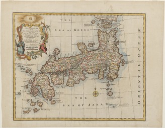
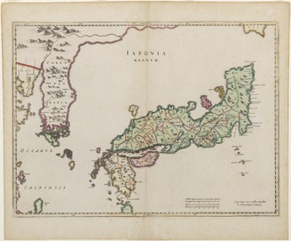
<i>New and Accurate Map of the Empire of Japan</i>
<i>The New and Accurate Map of Japan, Ezo, and Adjacent Islands</i>
Nautical Chart , Japan
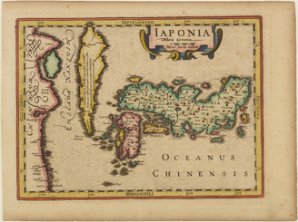
<i>Map of Japan</i>
<i>Map of Japan</i>
<i>Map of Japan</i>
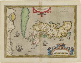
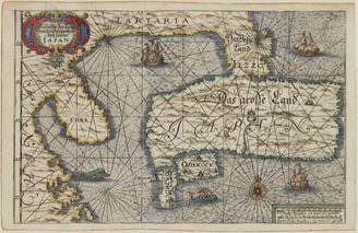
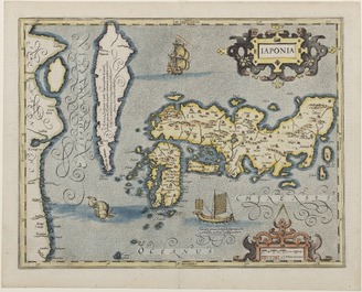
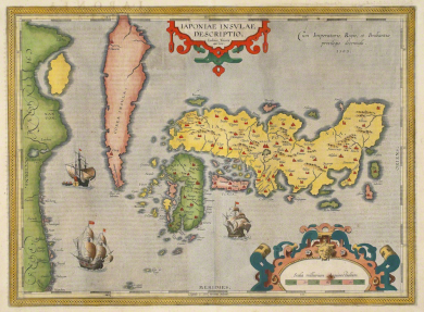
<i>Iaponiae insulae descriptio</i> (map of Japan)
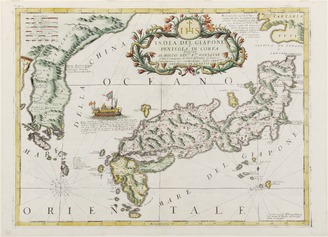
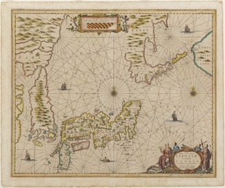
<i>Map of Japan and Korea</i>
Sea of Japan, Oki I
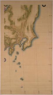
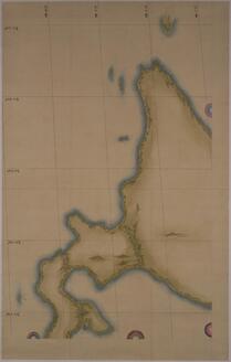
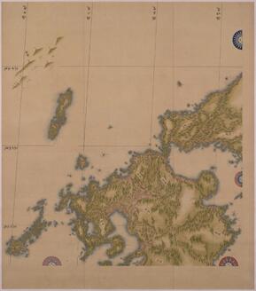
Map of Japan (Medium Scale): Kantō
The First Map of Japan in the Atlas

Félix Régamey gives lecture on the daily life of Japanese people
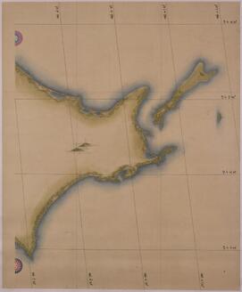
Maps of Japan: Eastern Hokkaido
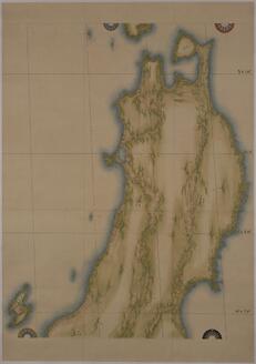
Map of Japan: Tōhoku Region
Map of Japan (Medium Scale): Western Hokkaido
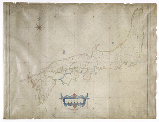
Map of Japan (Medium-Sized Map)
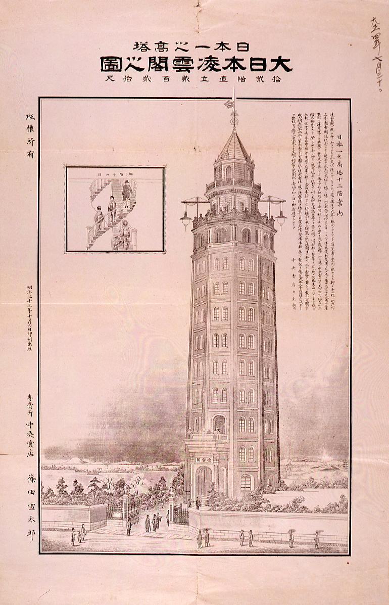
The High Tower of Japan : Ryounkaku Tower in Great Japan, The Twelve-Story Tower

Suddenly I felt better. Maybe it was the magic of the old woman, or the gods had pity on me
Map of Japan (Medium-Scale Map): Northern Kyūshū
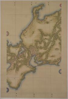
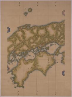
Map of Japan (Medium Scale): Chūbu and Kinki
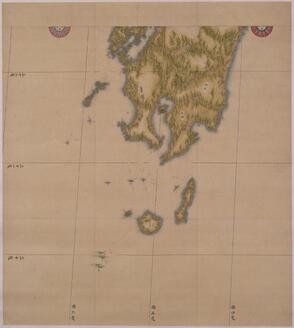
Map of Japan (Medium-Scale Map): Southern Kyūshū

The Blue-stockings 5: I say, Bichette... What are you thinking of..

Illustration of Kinryuzan Sensoji Temple in the Empire of Japan

Illustration of Kinryuzan Sensoji Temple in the Empire of Japan
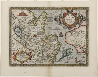
<i>Tartariae sive magni cham regni</i> (map of Tartar)
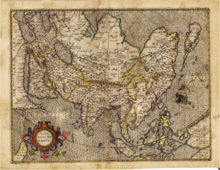
Ajiazu

La Table des Isles neusues, lesquelles on appelle isles d'occident & d'Indie pour divers regardz

Mar di India

Oogi awase Sumidagawa hakkei

Iroha-gana shiju-nana moji (Object)
Träsnitt, Bildkonst, Woodblock, Print, Woodcut

「扇合隅田川八景」 「関屋乃つみ草」
Nakamura Utaemon III. jako kiiči Hógen

Nakamura Utaemon
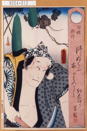
「百姓弥作」

Maris Pacifici quod vulgo Mar del Zud
![[永福東京御繪圖]](https://lapis.nichibun.ac.jp/image?did=6&pic=2&fid=10-6_01_01.jpg)
[永福東京御繪圖]
Thunder God amid the Clouds

「十二月ノ内」 「極月」

「今若丸八才後に頼朝」「牛若丸二才後に義経」
.jpg)
「半時九郎兵衛」

「千代寿士大平」 「千代寿」「はんゑい」「他」

Irohaganashijuushichimoji、kanagarikaguraonoko

Genjikumoukiyoeawase

Analogs of Scenes from "Tale of Genji" : Nowaki
Träsnitt, Bildkonst, Woodcut, Woodblock, Print

Meka Magosaburoo Nagamune

Last Updated: 2025-07-22T01:06:05
Uploaded: 2025-07-23