

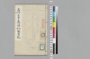
西方三十三所順拝
Tokyo Metropolitan Central Library
Tokyo Metropolitan Library Edo-Tokyo Digital Collections

「西方三十三所順拝」
Tokyo Metropolitan Central Library
ARC Ukiyo-e Portal Database

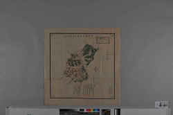
葛西三十三観音順拝画図
Tokyo Metropolitan Central Library
Tokyo Metropolitan Library Edo-Tokyo Digital Collections

西国三十三所名所図会
北海道大学附属図書館 (国文学研究資料館)
IIIF Discovery in Japan

西国三十三所名所図会
National Institute of Japanese Literature
IIIF Discovery in Japan

西国順礼三十三所/普陀落伝記
National Institute of Japanese Literature
IIIF Discovery in Japan

西国順拝道芝之記
筑波大学附属図書館 (国文学研究資料館)
IIIF Discovery in Japan

二十四輩順拝図会
National Institute of Japanese Literature
IIIF Discovery in Japan
![[西国三十三ヶ所めぐり絵図]](https://meta01.library.pref.nara.jp/mmd/thumbnail/300/138120/138120.jpg)
[西国三十三ヶ所めぐり絵図]
Nara Prefectural Library and Information Center
Mahoroba Digital Library
西國三十三所名所図曾
Tokyo National Museum
Integrated Collections Database of the National Museums, Japan

秩父順拝図絵
National Institute of Japanese Literature
IIIF Discovery in Japan
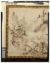
山陵順拝図絵
龍谷大学図書館
Ryukoku University Library Digital Archives "Ryukoku-zou"

三河三十三所順禮詠歌
ADEAC: A System of Digitalization and Exhibition for Archive Collections

三河三十三所順禮詠歌
ADEAC: A System of Digitalization and Exhibition for Archive Collections
三河三十三所順禮詠歌
ADEAC: A System of Digitalization and Exhibition for Archive Collections
参河三十三所順禮詠歌
ADEAC: A System of Digitalization and Exhibition for Archive Collections

色里三十三所息子順禮
National Diet Library, Japan
ARC Early Japanese Book Portal Database
三河三十三所順礼観音記
ADEAC: A System of Digitalization and Exhibition for Archive Collections
![[歴民カード_歴史] 西国三拾三所図](https://khirin-i.rekihaku.ac.jp/iiif/nmjh_rekimin_h/13147018_02.tif/full/200,/0/default.jpg)
[歴民カード_歴史] 西国三拾三所図
National Museum of Japanese History
IIIF Discovery in Japan
阿拝郡鞆田村地籍図/伊賀国阿拝郡西湯舟村全図
三重県環境生活部文化振興課
Specified Historical Public Records and Archives, Mie

三島大神:西国巡拝塔群
Choshi
ADEAC: A System of Digitalization and Exhibition for Archive Collections

東方観世音三十三所順路
Tokyo Metropolitan Central Library
Tokyo Metropolitan Library Edo-Tokyo Digital Collections

「東方観世音三十三所順路」
Tokyo Metropolitan Central Library
ARC Ukiyo-e Portal Database

三河国地図
National Diet Library, Japan
ARC Early Japanese Book Portal Database

Laurie and Whittle's New Chart of the Indian and Pacific Oceans Between the Cape of Good Hope, New...
Stanford University Libraries
Stanford Libraries SearchWorks
Pas-caert van't Oostelyckste deel van Oost Indien : met alle de Eylanden daer onder gelegen, van Cabo Comorin tot aen Japan / by Hendrick Doncker Boekverkooper en Graadbooghmaacker Inde Nieuwbrughsteegh
National Library of Australia
Trove: National Library of Australia

Laurie and Whittle's New Chart of the Indian and Pacific Oceans Between the Cape of Good Hope, New...
Stanford University Libraries
Stanford Libraries SearchWorks

「上州草津温泉之図」
Tokyo Metropolitan Central Library
ARC Ukiyo-e Portal Database
Laurie and Whittle's new chart of the Indian and Pacific Oceans between the Cape of Good Hope, New Holland and Japan : comprehending New Zealand, New Caledonia, New Britain, New Ireland, New Guinea &c., Louisiade and New Georgia; also The Pelew, New Caroline, Ladrone and Philippine Islands &c. with the most remarkable tracks of the English, Spanish, French and Dutch navigators and chiefly the track of the Walpole, EastIndiaman, Captn. Thos. Butler, 1794 from the Cape of Good Hope to Van Diemen's Land and from thence to China, and the track of the Royal Admiral Captn. Henr. Bond in 1792 and 93 from the Cape to Port Jackson and China
State Library of New South Wales
Trove: National Library of Australia

「〔箱根絵図〕」
Tokyo Metropolitan Central Library
ARC Ukiyo-e Portal Database

「〔御用屋敷地図〕」
Tokyo Metropolitan Central Library
ARC Ukiyo-e Portal Database
![「[桃太郎]」 「〔疱瘡に関する絵〕」](https://archive.library.metro.tokyo.lg.jp/da/download/?id=0000000003-00224601&size=thumb&type=image&file=/浮世絵/778-C017.jpg)
「[桃太郎]」 「〔疱瘡に関する絵〕」
Tokyo Metropolitan Central Library
ARC Ukiyo-e Portal Database
耕作図屏風
Tokyo National Museum
ARC Ukiyo-e Portal Database

A Correct Sea Chart of the Whole World, According to Wright's, Commonly Called Mercator's, Project...
Stanford University Libraries
Stanford Libraries SearchWorks
Last Updated: 2019-07-07
Uploaded: 2023-04-03