


.jpg)

.jpg)
.jpg)


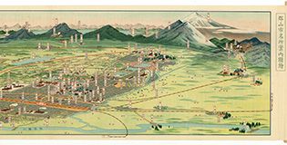

冨士山名細図并東海名所之図

Gamatekkai

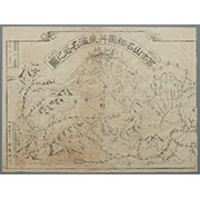
駿河国富士山頂上八葉内院八方遠見図

Tabula Geodoborica Itinerum a Varijs in Cataium susceptorum rationem exhibens (Kircher's map of hi...

Isei nagata tokuhonden
駿河国富士郡大宮国幣中社浅間神社之図

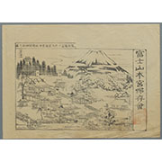
冨士山東口須走(登山案内図)
Japanese Empire--802 M

Shintei shiku kaisei Tōkyō meisai zenzu

L'Empire de la Chine avec les isles du Japon. A Paris, ches Lattre, rue St. Jacq. (ca. 1800)
Paskaerte zynde t'Oosterdeel van Oost Indien : met alle de Eylanden daer ontrendt geleegen van C. Comorin to...
Illustrations of Birds and Flowers

Akebi
Nvova descrittione del Giappone
L'empire de la Chine : d'après l'atlas Chinois, avec les isles du Japon / par M. Bonne, Membre de la Societʹe Litteraire Militre. Ingenieur Gʹeographe &c

A Chart of the Eastermost part of the East Indies and China from Cape Comarin to Japan with the Ad...
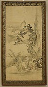
蘭亭曲水図屏風
「乗合船」

Asia According to the best Authorities

Karta Morskykh Otkrytii Rossiiskimi Moreplavatelimi na Tikhom ... [transliterated from the Cyrilli...

Kuniyoshi's preparatory drawings, no.48
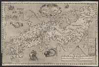
IAPONIA REGNVM
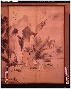
Hanging scroll

「鹿島香取筑波日光参詣順路図」
Last Updated: 2025-06-03T01:00:34
Uploaded: 2025-06-04