

Kaikoku zenzu
Yamanashi Prefectural Library
Yamanashi Digital Archive

Kaikoku zenzu
Yamanashi Prefectural Library
Yamanashi Digital Archive

Kaikoku zenzu
Yamanashi Prefectural Library
Yamanashi Digital Archive

Kaikoku zenzu
Yamanashi Prefectural Library
Yamanashi Digital Archive

Yamanashiken kaikoku zenzu
Yamanashi Prefectural Library
Yamanashi Digital Archive

Kaikoku ezu
Yamanashi Prefectural Library
Yamanashi Digital Archive

Nendai kijun kaikoku shikai
Yamanashi Prefectural Library
Yamanashi Digital Archive

Koufushi zenzu
Yamanashi Prefectural Library
Yamanashi Digital Archive

Koufushi zenzu
Yamanashi Prefectural Library
Yamanashi Digital Archive

Koufushi zenzu
Yamanashi Prefectural Library
Yamanashi Digital Archive

Koufushi zenzu
Yamanashi Prefectural Library
Yamanashi Digital Archive

Koufushi zenzu
Yamanashi Prefectural Library
Yamanashi Digital Archive

Koufushi zenzu
Yamanashi Prefectural Library
Yamanashi Digital Archive

Koufushi zenzu
Yamanashi Prefectural Library
Yamanashi Digital Archive

Koufushi zenzu
Yamanashi Prefectural Library
Yamanashi Digital Archive

Koufushi zenzu
Yamanashi Prefectural Library
Yamanashi Digital Archive

Koufushi zenzu
Yamanashi Prefectural Library
Yamanashi Digital Archive

Koufushi zenzu
Yamanashi Prefectural Library
Yamanashi Digital Archive

Koufushi zenzu
Yamanashi Prefectural Library
Yamanashi Digital Archive

Koufushi zenzu
Yamanashi Prefectural Library
Yamanashi Digital Archive

Koufu shigai zenzu
Yamanashi Prefectural Library
Yamanashi Digital Archive

Koufu shigai zenzu
Yamanashi Prefectural Library
Yamanashi Digital Archive

Koufu shigai zenzu
Yamanashi Prefectural Library
Yamanashi Digital Archive

Koufu shigai zenzu
Yamanashi Prefectural Library
Yamanashi Digital Archive
Kaikoku zenzu
Yamanashi Prefectural Library
Yamanashi Digital Archive
Kaikoku zenzu
Yamanashi Prefectural Library
Yamanashi Digital Archive
Kaikoku zenzu
Yamanashi Prefectural Library
Yamanashi Digital Archive
Kaikoku zenzu
Yamanashi Prefectural Library
Yamanashi Digital Archive
China and Japan / drawn and engraved for Dr. Playfair's Geography; engraved by H. Cooper, 28 Chancery Lane
National Library of Australia
Trove: National Library of Australia

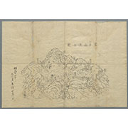
Taifuu nanagou ni yoru yamanashi kenka no shuyou saigai zu
Yamanashi Prefectural Library
Yamanashi Digital Archive

「〔箱根絵図〕」
Tokyo Metropolitan Central Library
ARC Ukiyo-e Portal Database
Koufushi zenzu
Yamanashi Prefectural Library
Yamanashi Digital Archive

Yamanashiken kannai zenzu
Yamanashi Prefectural Library
Yamanashi Digital Archive
Pas-caert van't Oostelyckste deel van Oost Indien : met alle de Eylanden daer onder gelegen, van Cabo Comorin tot aen Japan / by Hendrick Doncker Boekverkooper en Graadbooghmaacker Inde Nieuwbrughsteegh
National Library of Australia
Trove: National Library of Australia
A Garden of Celebrated Japanese and Chinese Paintings : [volume 2]
Metropolitan Museum of Art
The Metropolitan Museum of Art Digital Collection

Yamanashiken kannai zenzu
Yamanashi Prefectural Library
Yamanashi Digital Archive

「安芸厳島神社之図」
Tokyo Metropolitan Central Library
ARC Ukiyo-e Portal Database
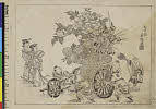
(童子女と花車)
C. V. Starr East Asian Library, University of California, Berkeley
ARC Ukiyo-e Portal Database

「坂東十九番大谷寺」
Tokyo Metropolitan Central Library
ARC Ukiyo-e Portal Database

Yamanashiken kannai zenzu
Yamanashi Prefectural Library
Yamanashi Digital Archive
富士山頂上図(表口、須山口)
Mt.Fuji World Heritage Center, Shizuoka
ADEAC: A System of Digitalization and Exhibition for Archive Collections

Toragaishi
Library of Congress
Digital Collections, Library of Congress
Uploaded: 2026-03-24