
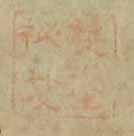
双□秘笈
National Institute of Japanese Literature
Collectors'Seals Database

□□
National Institute of Japanese Literature
Collectors'Seals Database
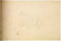
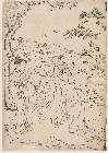
Sketch (From a Sketchbook)
Mie Prefectural Art Museum
Mie Prefectural Art Museum Collections
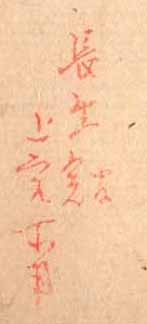
(長生館)
National Institute of Japanese Literature
Collectors'Seals Database

湖畔の声 昭和21年10月号
Omihachiman City Library
ADEAC: A System of Digitalization and Exhibition for Archive Collections
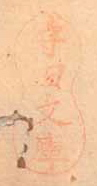
守田文庫
National Institute of Japanese Literature
Collectors'Seals Database

Figures and descriptions of the fishes of Japan : including Riukiu Islands, Bonin Islands, Formosa...
スミソニアン図書館
Europeana API
湖畔の声 昭和21年7月~昭和23年6月号
Omihachiman City Library
ADEAC: A System of Digitalization and Exhibition for Archive Collections
Jūmanbun no ichi Ranryō Boruneo : Barikkupapan fukin: XXIX/62 (16)
National Library of Australia
Trove: National Library of Australia
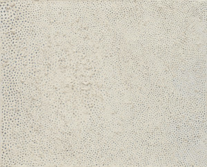
No. F
Museum of Modern Art, New York
The Museum of Modern Art (MoMA) Collection
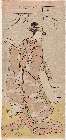
「四代岩井半四郎(いわいはんしろう)」
Museum of Fine Arts, Boston
ARC Ukiyo-e Portal Database
「花見」
Museum of Fine Arts, Boston
ARC Ukiyo-e Portal Database

職人合ノ畫
Kyoto University Library
IIIF Discovery in Japan
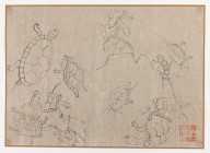
Turtle Studies
Brooklyn Museum
Brooklyn Museum API

Habarofusuku hōmen sozu : Gojūmanbun no ichi zu
Stanford University Libraries
Stanford Libraries SearchWorks
![[no title]](https://www.tate.org.uk/art/images/work/P/P07/P07961_8.jpg)
[no title]
Tate Gallery
The Tate Collection
Uploaded: 2026-03-25