National Geographic Society-Smithsonian Institution Expedition to the Dutch East Indies, 1937

National Geographic Society-Smithsonian Institution Expedition to the Dutch East Indies, 1937
Smithsonian Institution Archives
Europeana API

News from the Dutch East Indies
Netherlands Institute for Sound and Vision
Europeana API

News from the Dutch East Indies: landing of the Dutch troops on Bali
Netherlands Institute for Sound and Vision
Europeana API

News from the Dutch East Indies: landing of the Dutch troops on Bali
Netherlands Institute for Sound and Vision
Europeana API
Theater of war in the Pacific Ocean / compiled and drawn in the Cartographic Section of the National Geographic Society for the National Geographic Magazine
National Library of Australia
Trove: National Library of Australia

Japan and Korea / compiled and drawn in the Cartographic Section of the National Geographic Society ; James ...
Yale University Library
Yale University Library Digital Collections
Japan and adjacent regions of Asia and the Pacific Ocean / compiled and drawn in the Cartographic Section of the National Geographic Society
National Library of Australia
Trove: National Library of Australia

Indie moet vrij! Werkt en vecht ervoor! [The (Dutch East) Indies must be free! Work and Fight for ...
Stanford University Libraries
Stanford Libraries SearchWorks

A Chart of the Eastermost part of the East Indies and China from Cape Comarin to Japan with the Ad...
Stanford University Libraries
Stanford Libraries SearchWorks
A chart of the eastermost part of the East Indies with all the adjacent islands from Cape Comorin to Iapan / by Iohn Seller, Hydrographer to the King
National Library of Australia
Trove: National Library of Australia
Court Exh. No. 1348: Policy in regard to the independence of the East Indies. (Proposed by the competent officials of the Ministries concerned)
NDL Digital Collections
NDL Digital Collections
Court Exh. No. 1348: Policy in regard to the independence of the East Indies. Proposed by the competent officials of the Ministries concerned
NDL Digital Collections
NDL Digital Collections
A chart of the eastermost part of the East Indies with all the adjacent islands from Cape Comorin to Iapan / by Iohn Seller, Hydrographer to the King ; F. Lamb Sculp
State Library of New South Wales
Trove: National Library of Australia
Court Exh. No. 1344: "Course of Events Leading up to Decisions on Political Control and Reversion of the East Indies in the Second World War."
NDL Digital Collections
NDL Digital Collections
Court Exh. No. 1284: April 15, 1940, Foreign Minister Arita Replies to Newspapermen on the Question of the Netherlands East Indies. Excerpt from exhibit 770 for identification
NDL Digital Collections
NDL Digital Collections
Court Exh. No. 1029: "Measures to be taken towards natives in East Asia" (Measures from Burma). Prepared by the Radical Question Committee of the National Policy Research Institute Sept. 20, 1940
NDL Digital Collections
NDL Digital Collections
Court Exh. No. 1029: "Measures to be taken towards natives in East Asia" (Measures from Burma). Prepared by the Radical Question Committee of the National Policy Research Institute Sept. 20, 1940
NDL Digital Collections
NDL Digital Collections
Asia and its islands according to Danville : divided into empires, kingdoms, states, regions &ca. with the European possessions and settlements in the East Indies and an exact delineation of all the discoveries made in the Eastern parts by the English under Captn. Cook
State Library of New South Wales
Trove: National Library of Australia
Court Exh. No. 3666: Certificate of MIYAMA, Yozo, Chief of Document Section, First Demobilization Bureau, testifying to non-availability of Plan B (documents concerning the amount of gasoline decided necessary to be imported from U.S.A. and the Dutch Indies) which was formulated at the Liaison Conference on or about 22 Nov 1941
NDL Digital Collections
NDL Digital Collections
Court Exh. No. 2948: Telegram from Ambassador Nomura in Washington to Foreign Minister Togo dated 25 Nov 1941 re Secretary Hull's conversations with the Ambassador and Ministers of Great Britain, Australia, the Netherlands East Indies and China
NDL Digital Collections
NDL Digital Collections
A map of the East-Indies and adjacent countries : with settlements, factories, and territories : explaining what belongs to England, Spain, France, Holland, Denmark, Portugal, etc. with many remarks not extant in any other map / by H. Moll, geog
National Library of Australia
Trove: National Library of Australia
National Geographic Society-Smithsonian Institution Expedition to the Dutch East Indies, 1937
Smithsonian Institution Archives
Europeana API

inro
British Museum
British Museum Collection

Ishikari nisshi
Library of Congress
Digital Collections, Library of Congress

弘長百首
National Institute of Japanese Literature
IIIF Discovery in Japan
murasakishikibugenjimonogatarisugoroku
Waseda University Library
ARC Early Japanese Book Portal Database
nageougitenshikizuemurasakishikibuishiyamaasobigenjigojuuyonjou
Waseda University Library
ARC Early Japanese Book Portal Database
Detailed Sketches for Drawings of Birds and Flowers and Landscapes (Kacho sansui saiga zushiki)
Harvard Art Museums
Harvard Art Museums API

Kōhō Yōtei nisshi
Library of Congress
Digital Collections, Library of Congress

御傘難問 全
Tokushima Prefectural Archives
ADEAC: A System of Digitalization and Exhibition for Archive Collections

Imayo sekkin hinagata (Object)
British Museum
British Museum Collection

Keika hyakukiku (Object)
British Museum
British Museum Collection

如意輪観音像
Aichi Prefectural Museum of Art
The collection of Aichi Prefectural Museum of Art

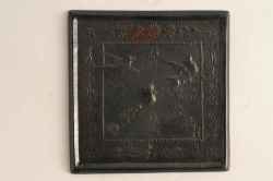
漆絵盆
Tokyo National Museum
Integrated Collections Database of the National Museums, Japan
Kagami
Mie Prefecture Archaeological Center
Mie Prefectural Archaeological Center Collections

جهان نما. Traité de géographie générale, par Katib Čelebi Moustafa Khalifa, dit Haği Khalifa, comp...
Bibliothèque nationale de France
Europeana API

Taraika Orotsuko kikō
Library of Congress
Digital Collections, Library of Congress
Last Updated:
Uploaded: 2021-07-27