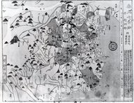
Cultural Japan
SearchCategoryEraNewsUsageSettings
  1. Top
  2. Search
  3. Road Maps of Kanagawa Prefecture
Road Maps of Kanagawa Prefecture
RDF DataOriginal Site

Road Maps of Kanagawa Prefecture

License: Public Domain Mark
Owner Organization
NDL Digital Collections

More Like This

Maps - Kanagawa

Maps - Kanagawa

Kanagawa Prefecture

Kanagawa Prefecture

Tochigi Prefecture - Maps

Tochigi Prefecture - Maps

Miyagase, Kanagawa Prefecture

Miyagase, Kanagawa Prefecture

List of Industrial Plants in Kanagawa Prefecture

List of Industrial Plants in Kanagawa Prefecture

Kanagawa Prefecture National Elections

Kanagawa Prefecture National Elections

Miura Peninsula, Kanagawa Prefecture

Miura Peninsula, Kanagawa Prefecture

Control Association - Kanagawa Prefecture

Control Association - Kanagawa Prefecture

KaCAR Natural Resources - File Petitions of Kanagawa Prefecture

KaCAR Natural Resources - File Petitions of Kanagawa Prefecture

Industrial Plants in Kanagawa Prefecture

Industrial Plants in Kanagawa Prefecture

Maps & List of Cities, Towns & Villages in the Prefecture of Kanto Region

Maps & List of Cities, Towns & Villages in the Prefecture of Kanto Region

Maps of Tokyo City: Road maps. Report No. 56a(22)(e), USSBS Index Section 2

Maps of Tokyo City: Road maps. Report No. 56a(22)(e), USSBS Index Section 2

List of Trade Union in Kanagawa Prefecture, Registered Numbers from 100 to 199

List of Trade Union in Kanagawa Prefecture, Registered Numbers from 100 to 199

Mother and her kids on snow road of Echigo in Migata Prefecture

Mother and her kids on snow road of Echigo in Migata Prefecture

Kumamoto: Maps of Kumatoto Prefecture. Report No. 58b(6)(k), USSBS Index Section 2

Kumamoto: Maps of Kumatoto Prefecture. Report No. 58b(6)(k), USSBS Index Section 2

"Village of Kanagawa"

"Village of Kanagawa"

Maps of Osaka-Kobe Area: Fukui Prefecture. Report No. 58a(4)(d), USSBS Index Section 2

Maps of Osaka-Kobe Area: Fukui Prefecture. Report No. 58a(4)(d), USSBS Index Section 2

Maps of Osaka-Kobe Area: Hyogo Prefecture. Report No. 58a(4)(e), USSBS Index Section 2

Maps of Osaka-Kobe Area: Hyogo Prefecture. Report No. 58a(4)(e), USSBS Index Section 2

Maps of Osaka-Kobe Area: Wakayama Prefecture. Report No. 58a(4)(g), USSBS Index Section 2

Maps of Osaka-Kobe Area: Wakayama Prefecture. Report No. 58a(4)(g), USSBS Index Section 2

Book: Maps of China

Book: Maps of China

"Sea-coast of Kanagawa"

"Sea-coast of Kanagawa"

Main Street of Kanagawa

Main Street of Kanagawa

Topology of special generic maps and simple fold maps

Topology of special generic maps and simple fold maps

Structure of Prefecture

Structure of Prefecture

Last Updated:

Uploaded: 2020-12-17

Cultural Japan

  • About this site
  • Team
  • News
  • Policy
  • Contact
  • For Developers

Tools

  • Search
  • Browse by Category
  • Browse by Place
  • Browse by Era
  • RDF Store

Usage

  • Self Museum
  • Cultural Japan Exhibitions Archive
  • Comparison of Kuni-ezu (Map)
  • NPL Visualization
  • IIIF Collection
  • Other Examples

Links

  • Japan Search
  • Japan Search unofficial support page
  • Europeana
  • DPLA
  • Trove
  • Twitter
Cultural Japan