
Facsimile of the official map made by Abel Janszoon Tasman's expedition to Japan in 1639

Graphic Scenes of the Japan Expedition by William Heine
10 GRAPHIC SCENES OF THE JAPAN EXPEDITION BY WILLIAM HEINE
Japan opened compiled chiefly from the narrative of the American expedition to Japan, in the years...
2nd of 10 GRAPHIC SCENES OF THE JAPAN EXPEDITION BY WILLIAM HEINE
10th of 10 GRAPHIC SCENES OF THE JAPAN EXPEDITION BY WILLIAM HEINE
9th of 10 GRAPHIC SCENES OF THE JAPAN EXPEDITION BY WILLIAM HEINE
5th of 10 GRAPHIC SCENES OF THE JAPAN EXPEDITION BY WILLIAM HEINE
7th of 10 GRAPHIC SCENES OF THE JAPAN EXPEDITION BY WILLIAM HEINE
1st of 10 GRAPHIC SCENES OF THE JAPAN EXPEDITION BY WILLIAM HEINE
3rd of 10 GRAPHIC SCENES OF THE JAPAN EXPEDITION BY WILLIAM HEINE
6th of 10 GRAPHIC SCENES OF THE JAPAN EXPEDITION BY WILLIAM HEINE
8th of 10 GRAPHIC SCENES OF THE JAPAN EXPEDITION BY WILLIAM HEINE
4th of 10 GRAPHIC SCENES OF THE JAPAN EXPEDITION BY WILLIAM HEINE
Japan (North) special strategic map / compiled by the Army Map Service
Japan (South) special strategic map / compiled by the Army Map Service

Narrative of the expedition of an American squadron to the China Seas and Japan performed in the y...

Narrative of the expedition of an American squadron to the China Seas and Japan performed in the y...

Narrative of the expedition of an American squadron to the China Seas and Japan performed in the y...

Narrative of the expedition of an American squadron to the China Seas and Japan : performed in the...

Narrative of the expedition of an American squadron to the China Seas and Japan : performed in the years 185...
Chart of the Kuro Siwo or Japan Stream of the Pacific : analogous to the Gulf Stream of the Atlantic, as investigated by the Officers of the U.S. Japan Expedition in 1854

Crinoids from Dr. S. Bock's expedition to Japan, 1914
Crinoids from Dr. S. Bock's expedition to Japan, 1914
Map of Japan / by the Welcome Society ; engraved by H. Kobayashi
![[噂森血汐机]](https://da.dl.itc.u-tokyo.ac.jp/portal/sites/default/files/styles/large/public/images/assets/kuroki/1af2f6eb-e1b8-4984-b6df-22b85c369c10_5.jpg?itok=UL98bJyP)
[噂森血汐机]

China, Japan >> Kaart van een gedeelte der Chinesche Zee en Kust, van Punta Lampa cao tot de...
上山英一郎・封書
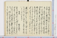
富田付近植物採集行・画および歌

覚(郡代鮎喰川筋見分に付費用借用書)
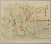
金山、及位での配置図 : (第四号 金山及位近傍略図)

Part 1, Volume 7 of Picture book of the exploits of Toyotomi Hideyoshi (Ehon Toyotomi kunkōki shohen shichi)
「語彙表現の分類」についてのメモ

China, Japan >> Kaart van de Rivier van Canton, van den Mond tot Anhingfu
-五百らかん由来 くうや上人道行

版芸術
中山切(古今集巻第十九)
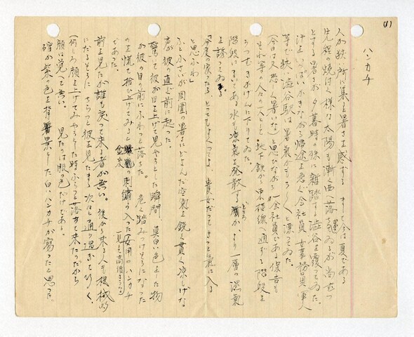
「ハンカチ」(深柄光勇が書いた小説)
-同巻(真野長者) 干珠満珠姫道行
![[下図]「砺波郡之内五箇山絵図」(文政五年)](https://adeac.jp/items/imizu-shinminato-mus/catalog/mp104440-15100/3-1-BIII42v2.jpg)
[下図]「砺波郡之内五箇山絵図」(文政五年)

松山城下から各前線地への方向図(続き) : (第一号 新庄闔境略図(続き))
-栗島御縁起 御田植 (目録題)
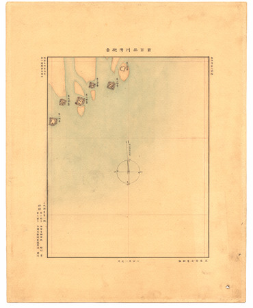
東京品川湾砲臺

China, Japan >> Kaart van een gedeelte der Chinesche Zee en Kust, van het Eiland Heitan tot ...
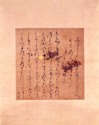
手鑑「藻塩草」 歌集断簡(天竜寺切)

手鑑「藻塩草」 古今和歌集巻第十七断簡(豊後切)
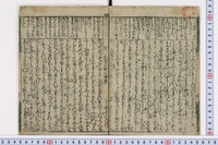
御成敗式目
![[頃日御返書相成候管下商人之者云々]](https://da.dl.itc.u-tokyo.ac.jp/portal/sites/default/files/styles/large/public/images/assets/gaikotsu/40fbea16-2d4f-7854-7fb4-0a26c90d6573_1.jpg?itok=a1xSG5Z5)
[頃日御返書相成候管下商人之者云々]
![[歳]旦松の寿](https://da.dl.itc.u-tokyo.ac.jp/portal/sites/default/files/styles/large/public/images/assets/kuroki/4eef4754-6312-44db-acee-fd440693cd1c_5.jpg?itok=zhsF1Y2a)
[歳]旦松の寿
最終更新日: 2020-06-05
登録日: 2021-07-22